Home
Shop
Cart
Account
Account
Australia
International
Topographic
Wall Maps
Nautical
Flags
Globes
Gifts & Gear
Home
Store
Recreational Inshore Charts for Western Australia
Recreational Inshore Charts for Western Australia
Filters
Sort:
Latest Arrivals
Price
Min
-
Max
Apply
Collections
Google Shopping
Europe - Maps, Guides & Road Atlases
Celestial
Africa - Maps & Guides
A Frontpage
Asia - Maps, Guides & Road Atlases
Vintage National Geographic Maps
4WD and Camping
South America - Maps & Guides
International Maps & Guides
World Maps
Healthcare
New South Wales Wall Maps
Supersized Business Wall Maps
North America - Maps, Guides & Road Atlases
Historical Wall Maps
Australian Cities, States and Territories Wall Maps
Binoculars
New South Wales - Maps, Guides, Road Atlases,Digital Mapping & Street Directories
Historical Charts
Sort:
Latest Arrivals
1
2
3
4
5
999 - Houtman Abrolhos - Wallabi Group DPI Chart (2018)
$55.00
Quick View
-70%
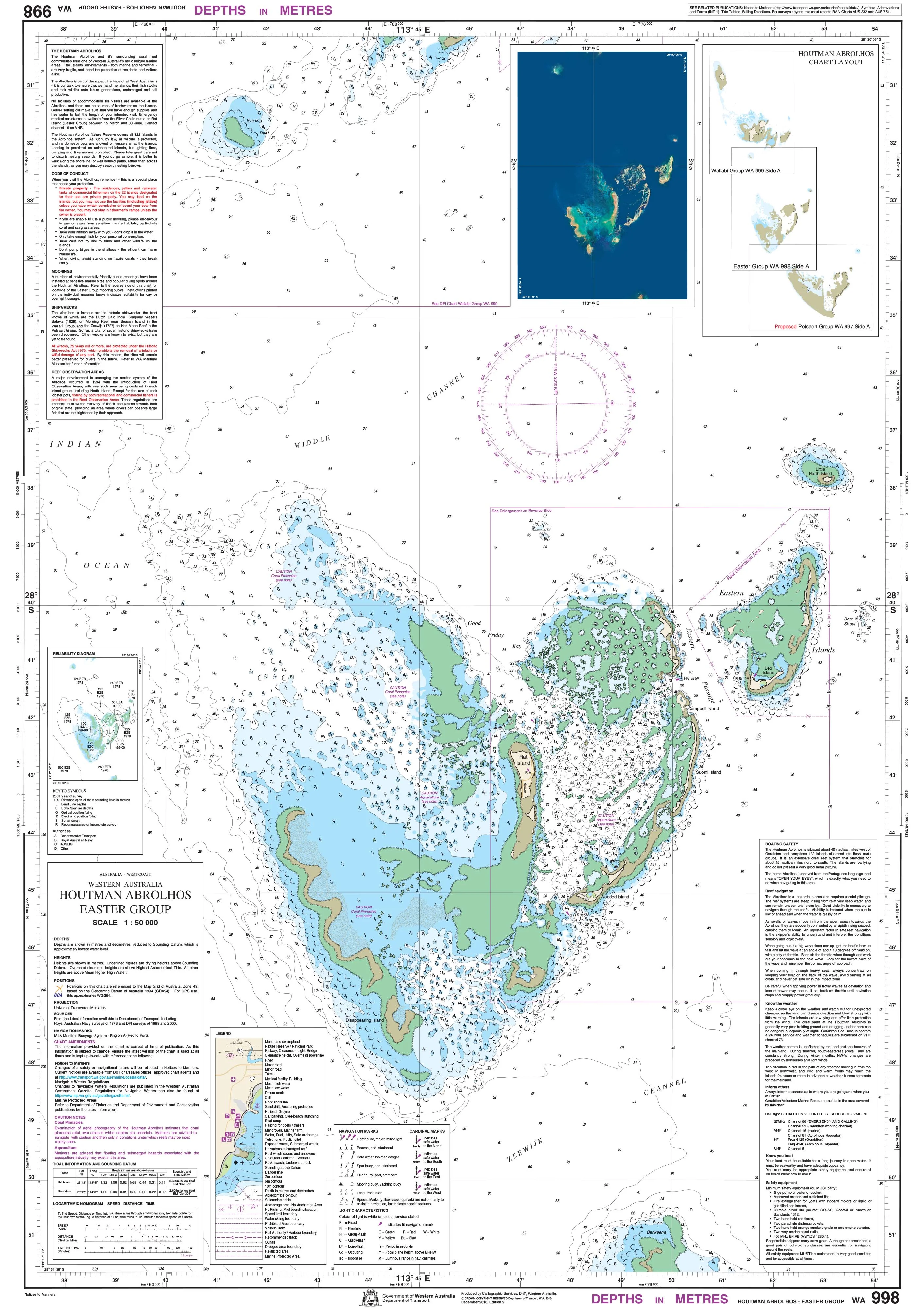
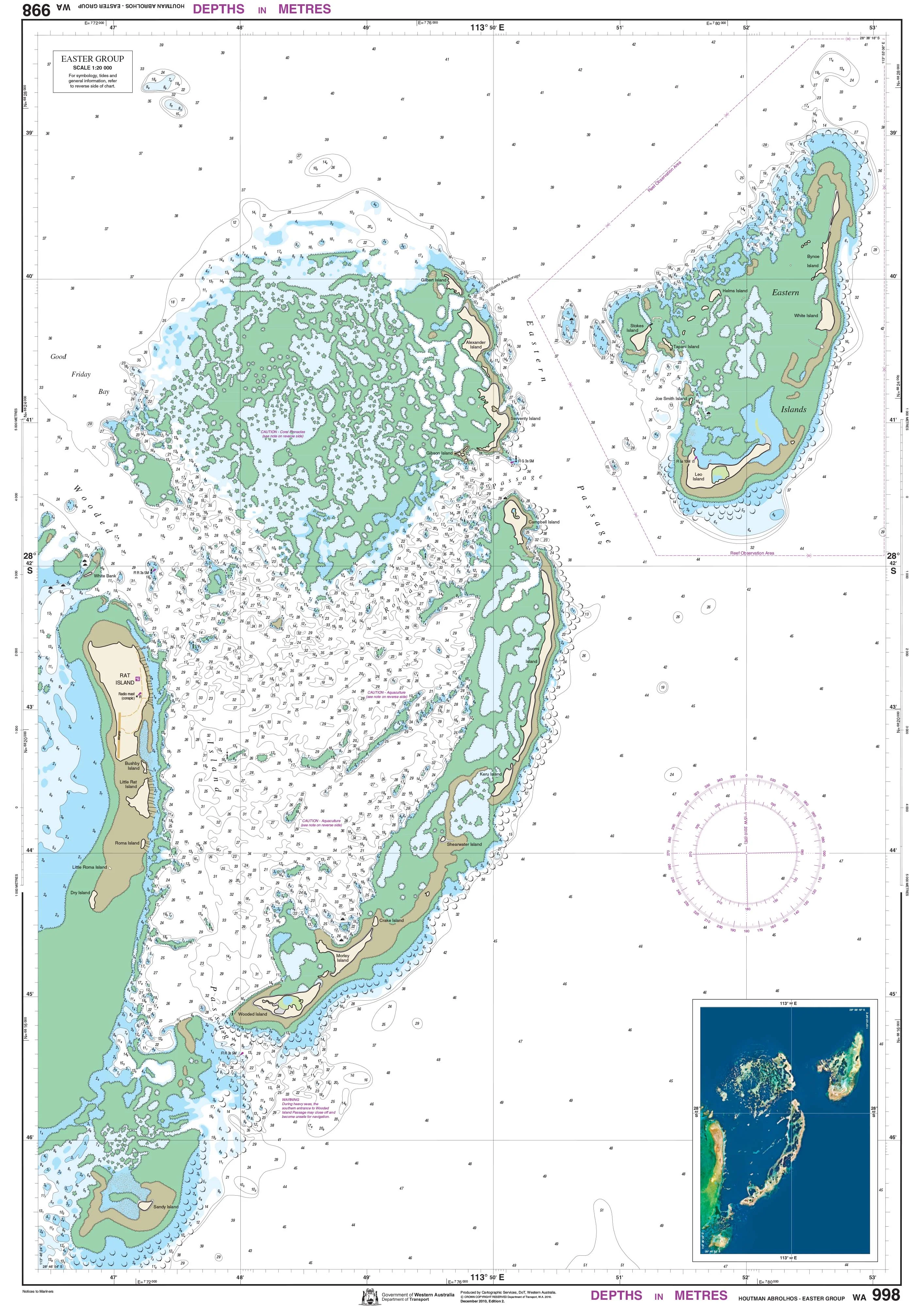
998 - Houtman Abrolhos - Easter Group DPI Chart (2010)
$55.00
$16.50
Quick View
-70%
1083 - Albany DPI Chart (2022)
$65.00
$19.50
Quick View
-70%
776 - Preston to Bunbury DPI Chart
$55.00
$16.50
Quick View
-70%
722 - Shoal Point DPI Chart
$55.00
$16.50
Quick View
-70%
1046 - Nornalup Inlet DPI Chart
$55.00
$16.50
Quick View
422 - Cervantes DPI Chart
$55.00
Quick View
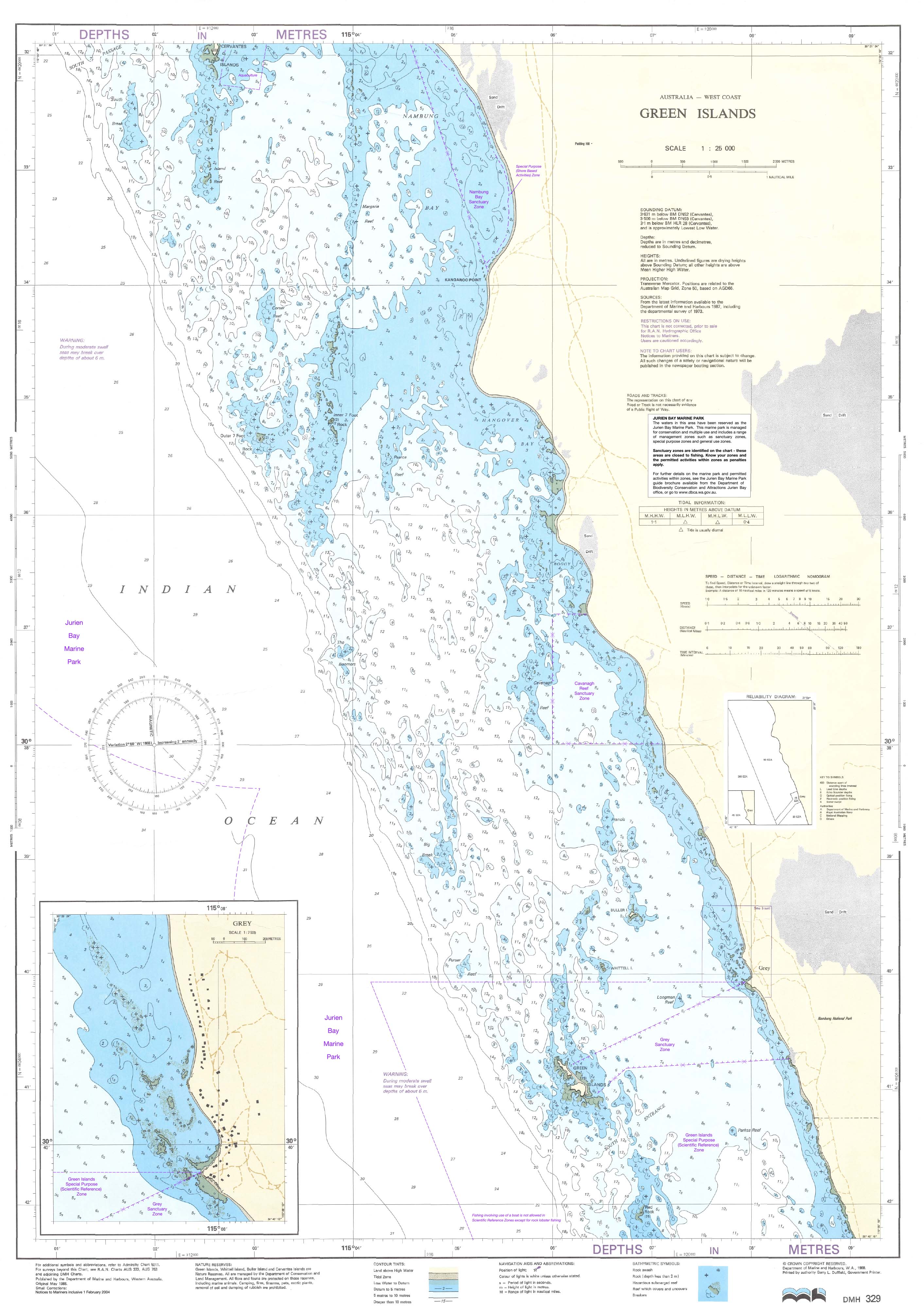
329 - Green Islands DPI Chart
$55.00
Quick View
-70%
767 - Dide Bay DPI Chart
$55.00
$16.50
Quick View
-70%
938 - Greenough DPI Chart
$55.00
$16.50
Quick View
-70%
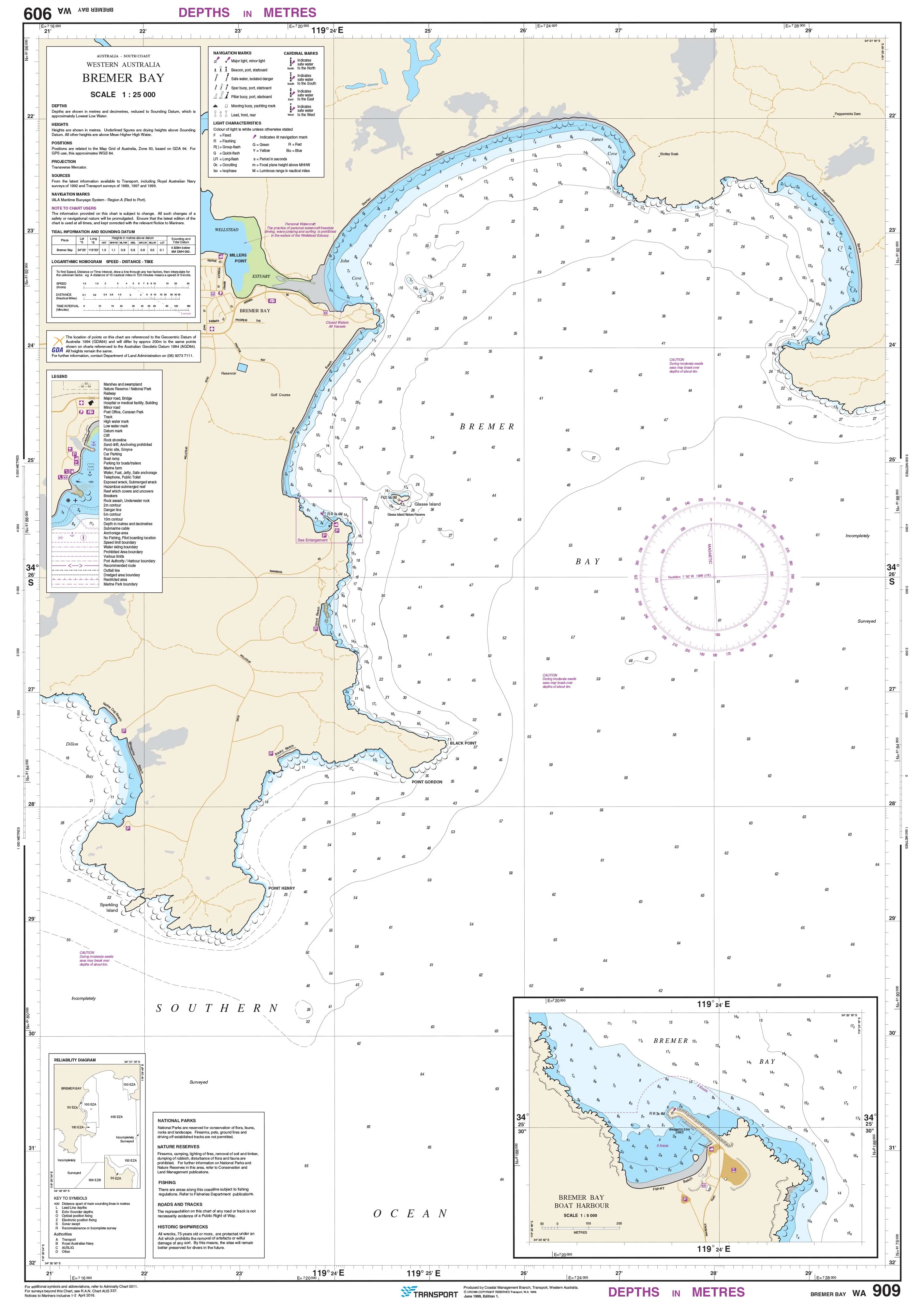
909 - Bremer Bay DPI Chart
$55.00
$16.50
Quick View
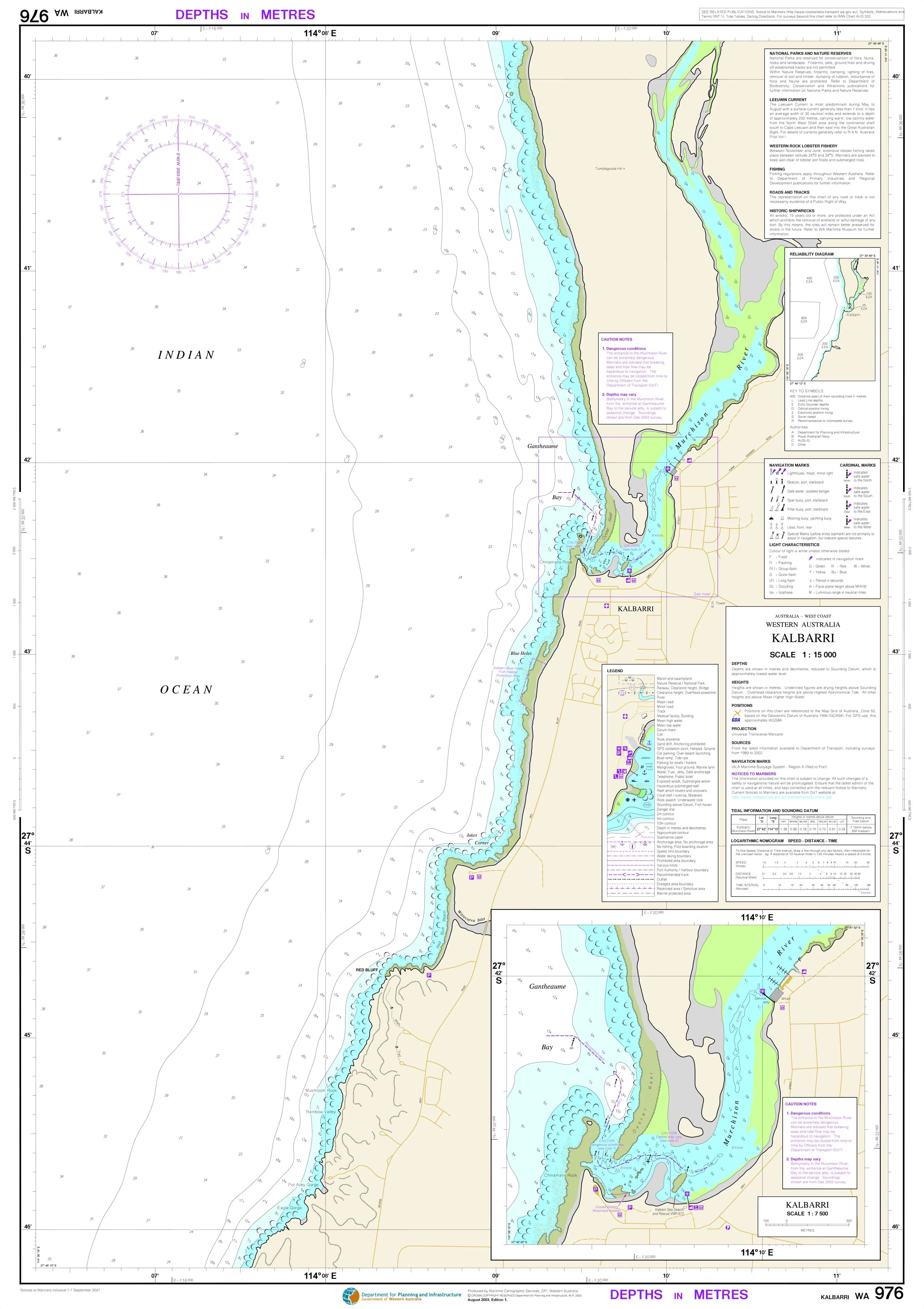
976 - Kalbarri DPI Chart
$55.00
Quick View