2429 Tambellup 1:100k Topographic Map
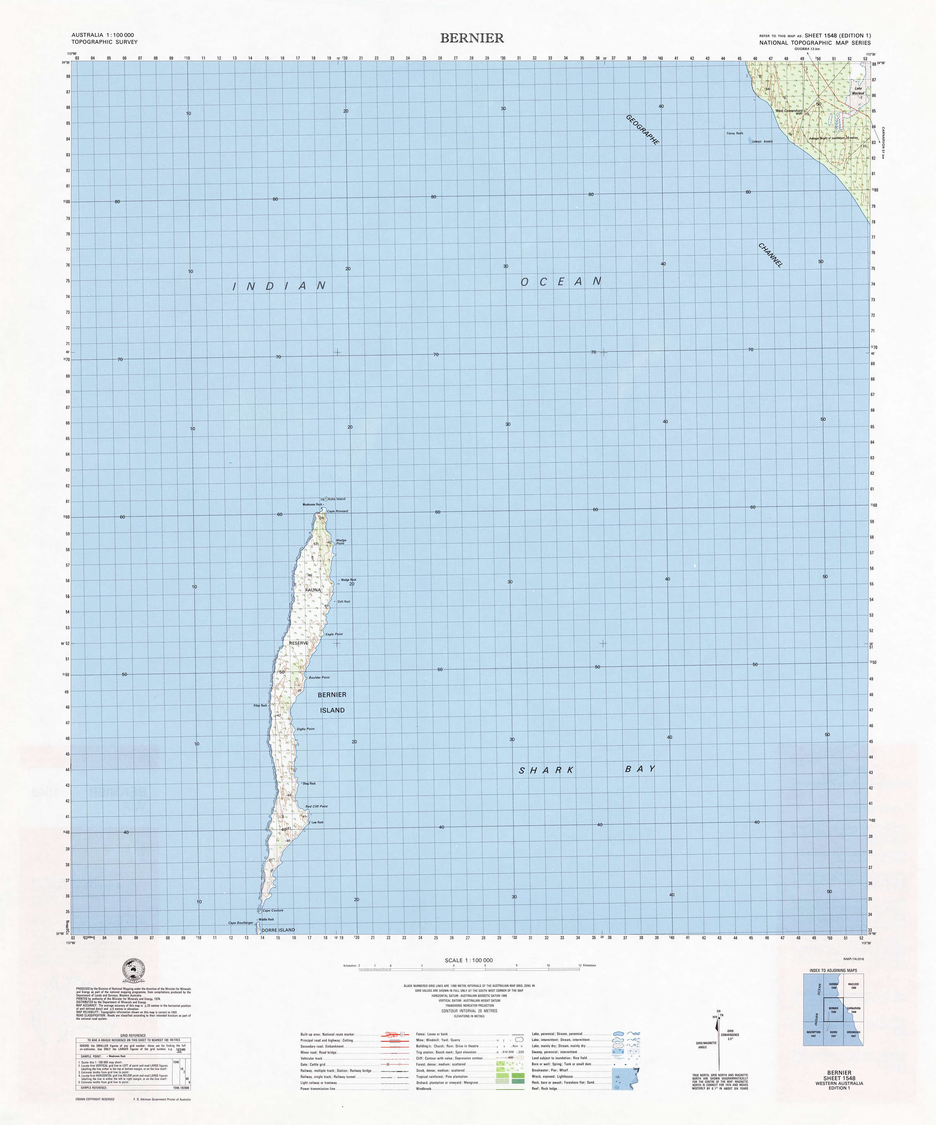
At a scale of 1:100,000, 1cm on the map represents 1km on the ground. Each map covers a minimum area of 0.5 degrees longitude by 0.5 degrees latitude or about 54 kilometres by 54 kilometres. The contour interval is 20 metres. Many maps are supplemented by hill shading.
Topographic maps show contours, spot elevations, streams, roads, buildings, place names, vegetation and administrative boundaries. They are used by emergency services, environmental resource managers, engineers and others for planning, development and recreational activities.
If you would like to use this map in the field, then we can supply it on waterproof/tearproof DuPont™ Tyvek®. Tyvek® is made of pure polyethylene fibres (plastic) but has the properties of paper, which means it is foldable.
We can also laminate this map, which will allow you to draw on it in whiteboard marker or apply our map dots to locations of interest without permanently marking the map. The lamination also makes the map very durable and protects against tears and stains.
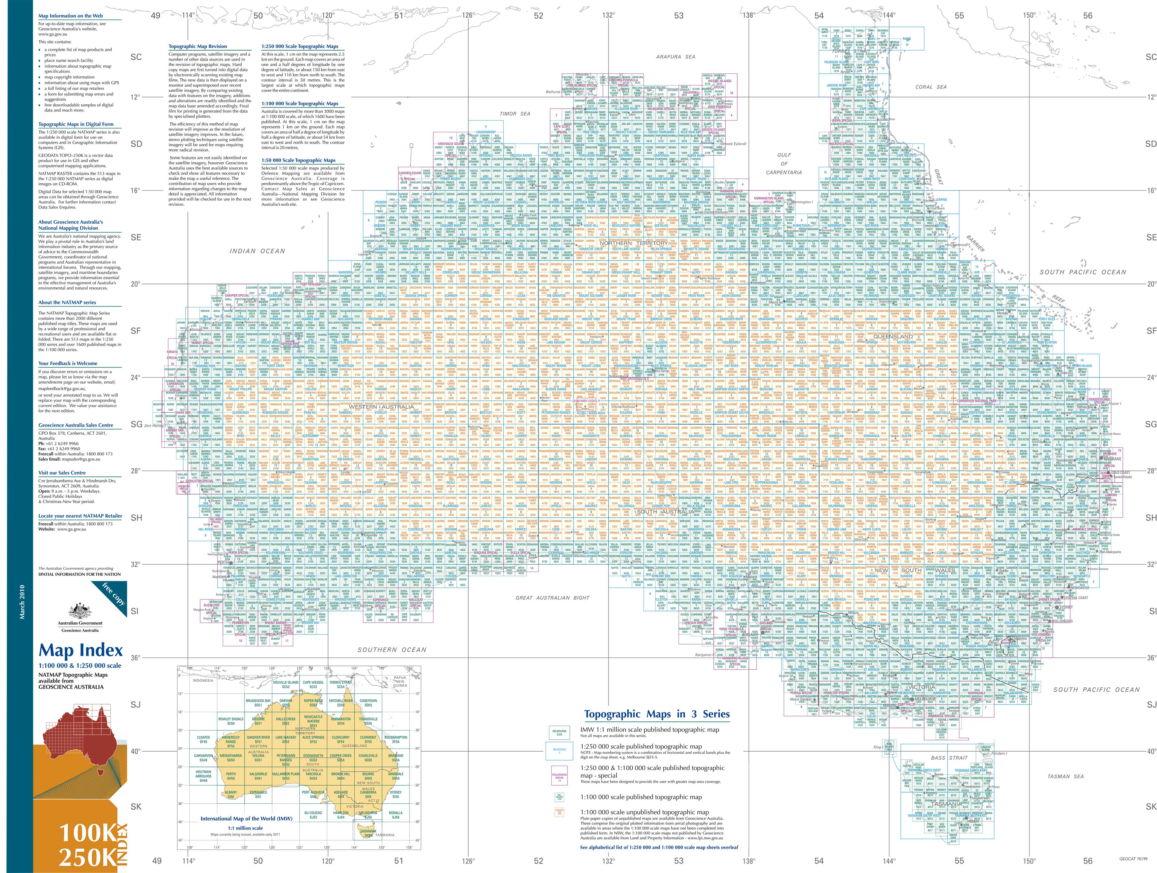
To see a full index, please click: Australia 100k & 250k
Currency: 1961 to 2008
Coordinates: Geographical and either AMG or MGA coordinates
Datum: AGD66, GDA94; AHD
Projection: Universal Transverse Mercator (UTM)
Scale: 1:100,000
Size: 590 mm (w) x 710 mm (h)
Original: $19.95
-70%$19.95
$5.98

Description
At a scale of 1:100,000, 1cm on the map represents 1km on the ground. Each map covers a minimum area of 0.5 degrees longitude by 0.5 degrees latitude or about 54 kilometres by 54 kilometres. The contour interval is 20 metres. Many maps are supplemented by hill shading.
Topographic maps show contours, spot elevations, streams, roads, buildings, place names, vegetation and administrative boundaries. They are used by emergency services, environmental resource managers, engineers and others for planning, development and recreational activities.
If you would like to use this map in the field, then we can supply it on waterproof/tearproof DuPont™ Tyvek®. Tyvek® is made of pure polyethylene fibres (plastic) but has the properties of paper, which means it is foldable.
We can also laminate this map, which will allow you to draw on it in whiteboard marker or apply our map dots to locations of interest without permanently marking the map. The lamination also makes the map very durable and protects against tears and stains.
To see a full index, please click: Australia 100k & 250k
Currency: 1961 to 2008
Coordinates: Geographical and either AMG or MGA coordinates
Datum: AGD66, GDA94; AHD
Projection: Universal Transverse Mercator (UTM)
Scale: 1:100,000
Size: 590 mm (w) x 710 mm (h)