Asia National Geographic Folded Map
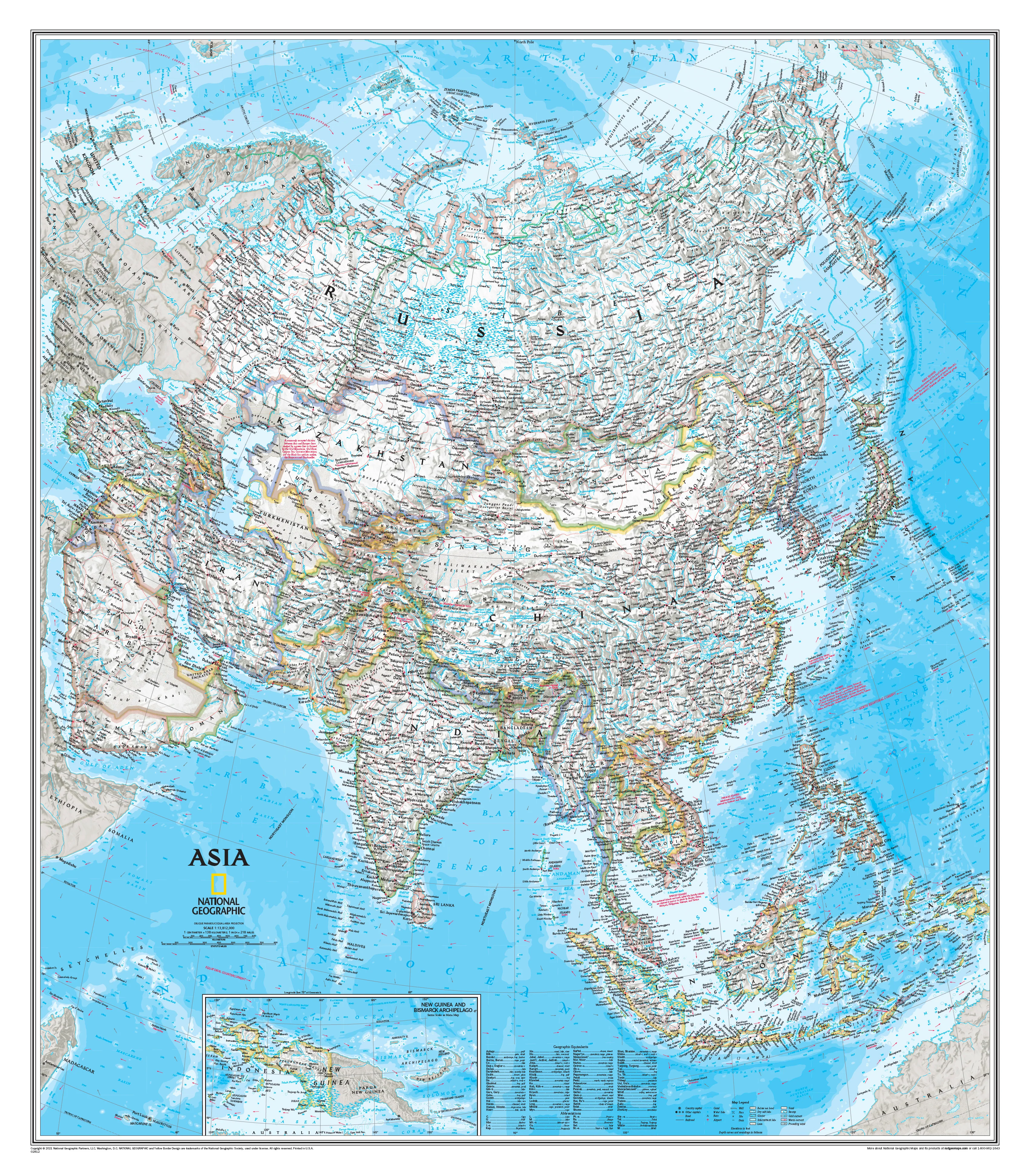
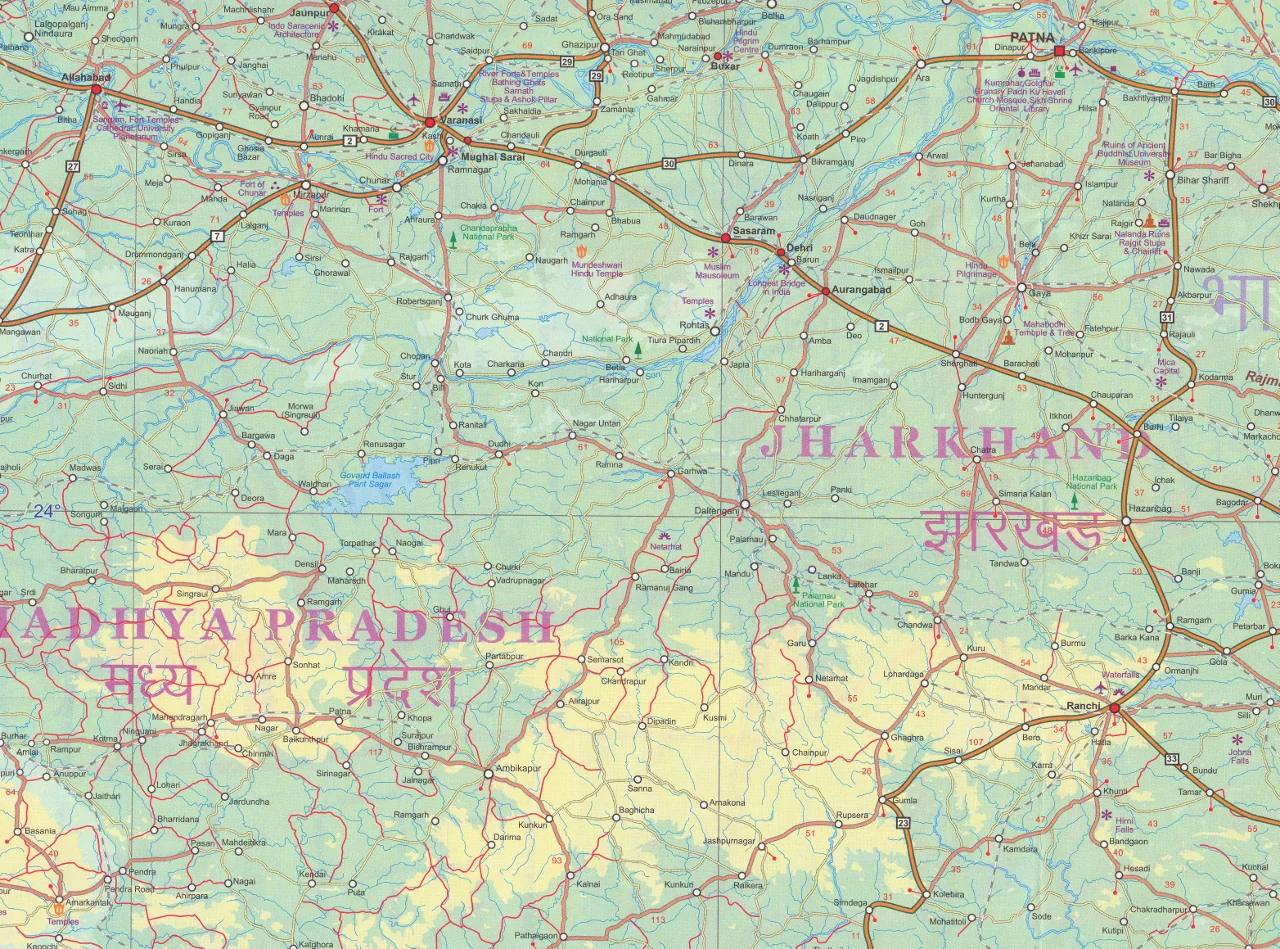
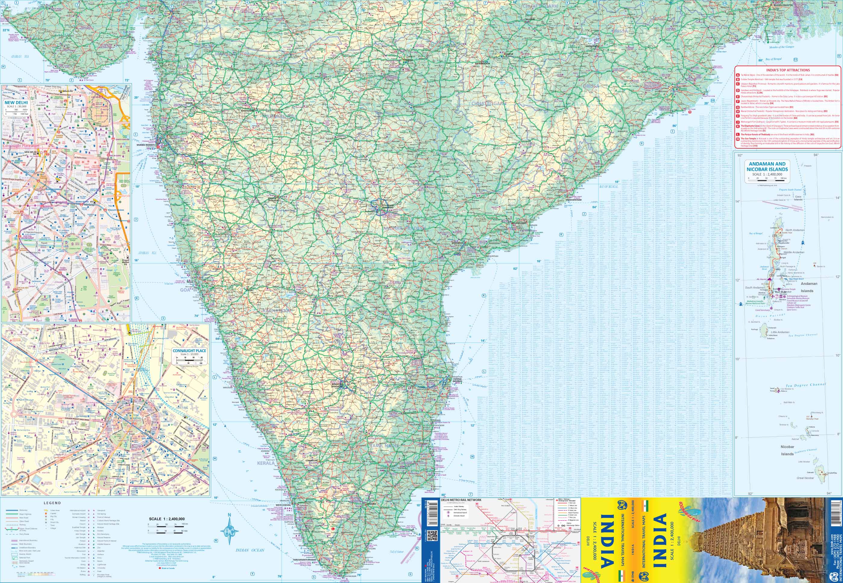
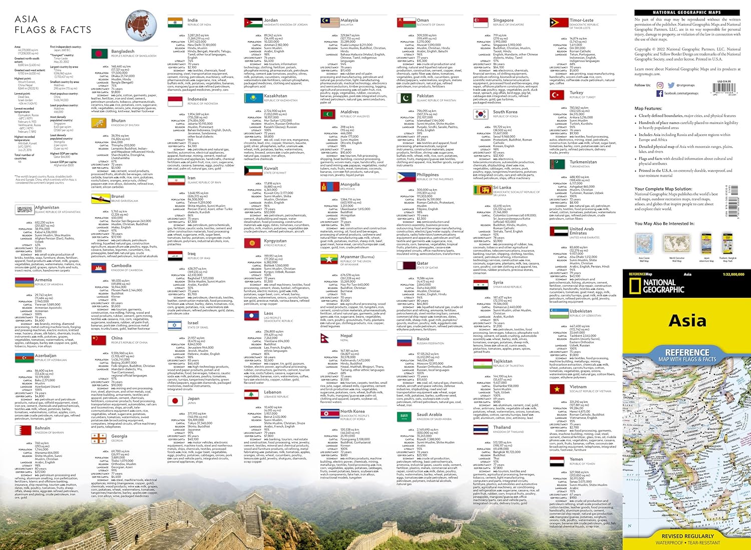
Expertly researched and designed, National Geographic's Asia Flags & Facts Map is the authoritative map of Asia by which other reference maps are measured. The map side includeds a political map showing countries, cities and other landmarks and a physical map shows the landforms such as mountain ranges and rivers.
- Clearly defined boundaries, major cities, and physical features
- Hundreds of place names carefully placed to maintain legibility in heavily populated areas
- Includes Asia including Russia and adjacent regions within Europe and Africa
- Detailed physical map of Asia with mountain ranges, plains, lakes, and rivers
- Flags and facts with detailed information about cultural and physcial attributes
- Printed in the U.S.A. on extremely durable, waterproof, and tear-resistant material
This Reference Map is printed on durable synthetic paper, making it waterproof, tear-resistant and tough -- capable of withstanding the rigors of any kind of use in the home or classroom.
- Sheet Size = 18.5" x 25.25"
- Folded Size = 4.25" x 9.25"
Original: $29.95
-70%$29.95
$8.98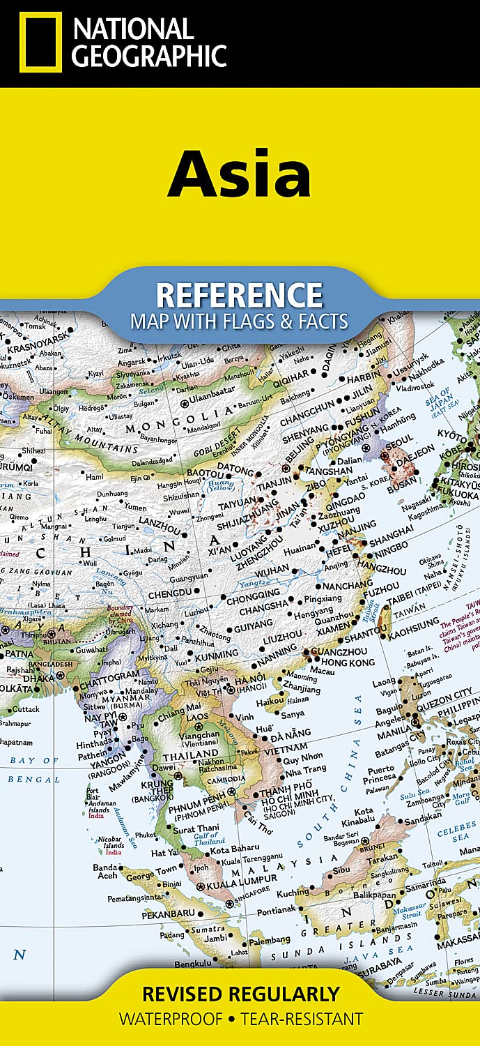

Description
Expertly researched and designed, National Geographic's Asia Flags & Facts Map is the authoritative map of Asia by which other reference maps are measured. The map side includeds a political map showing countries, cities and other landmarks and a physical map shows the landforms such as mountain ranges and rivers.
- Clearly defined boundaries, major cities, and physical features
- Hundreds of place names carefully placed to maintain legibility in heavily populated areas
- Includes Asia including Russia and adjacent regions within Europe and Africa
- Detailed physical map of Asia with mountain ranges, plains, lakes, and rivers
- Flags and facts with detailed information about cultural and physcial attributes
- Printed in the U.S.A. on extremely durable, waterproof, and tear-resistant material
This Reference Map is printed on durable synthetic paper, making it waterproof, tear-resistant and tough -- capable of withstanding the rigors of any kind of use in the home or classroom.
- Sheet Size = 18.5" x 25.25"
- Folded Size = 4.25" x 9.25"