AUS 253 - Whitsunday Passage Nautical Chart
AUS 253 — Whitsunday Passage, QLD Nautical Chart
For skippers, bareboat crews, and island-hopping cruisers threading the Whitsundays
Bring Whitsunday Passage into crisp, working focus. AUS 253 is the go-to planning and pilotage sheet for shaping legs between the mainland and the islands—ideal for plotting channels and leads, setting landfall bearings, and cueing anchorage options in trade-wind conditions.
Why skippers choose this chart
-
🧭 Passage planning made clear — Clean coastline detail for reliable bearings and confident briefings.
-
🪨 Reef & shoal awareness — Helpful for bommie avoidance, reef clearances, and lee-shore choices.
-
🌬️ Trade-wind friendly — Plan tacks, laylines, and tide gates through the Passage.
-
✍️ Write-on laminate option — Soft-matte face takes chart-correction/grease pencils cleanly.
-
🇦🇺 Printed in Australia — Colour-managed, hand-checked.
Coverage
-
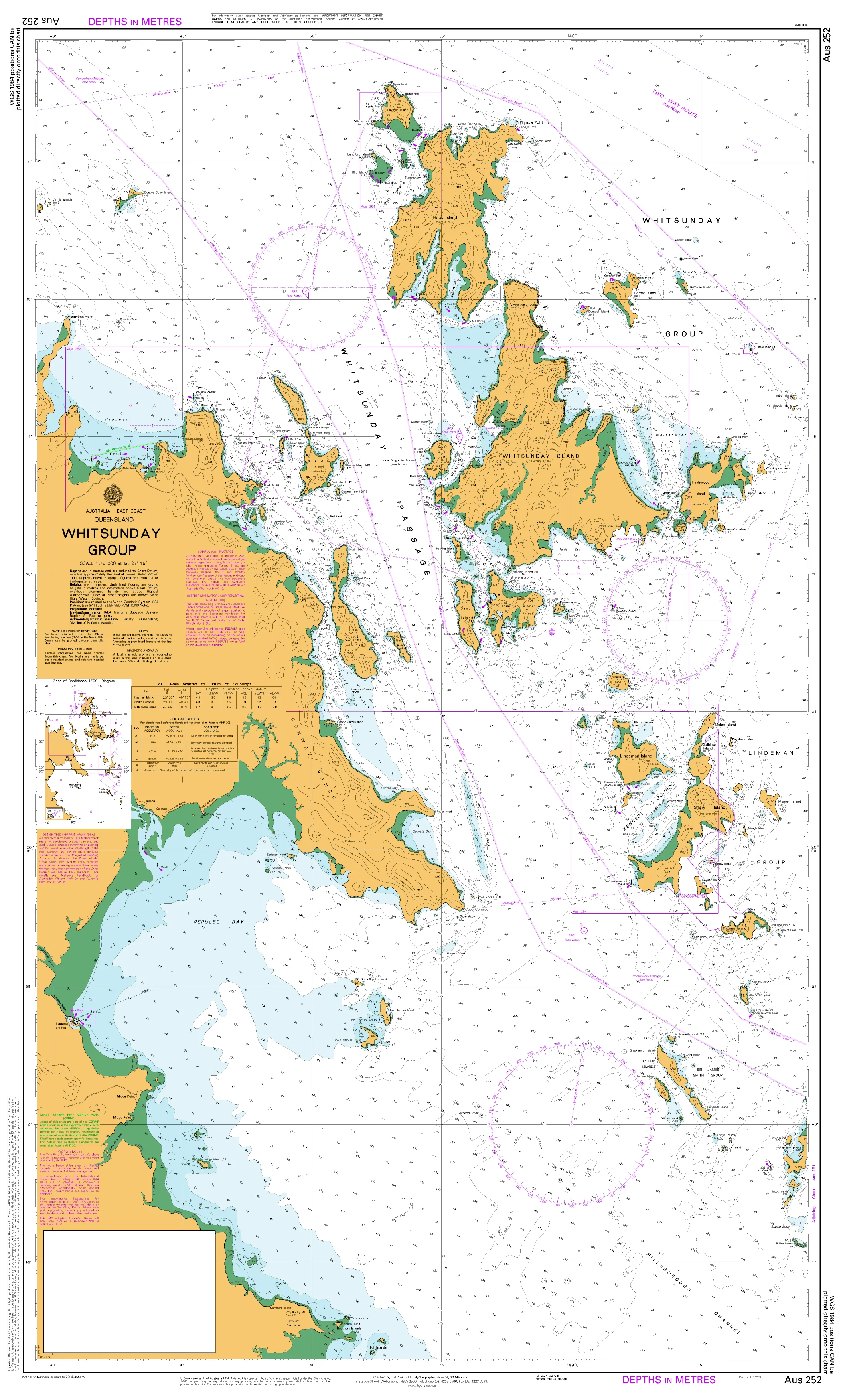
Main Chart — AUS 253: Australia · East Coast · Queensland · Whitsunday Passage
-
Scale: 1:37,500 · Projection: Mercator
-
Bounds: N 20°11.73′ S · S 20°25.00′ S · E 149°04.55′ E · W 148°40.50′ E
-
Latest Edition: 08-Apr-2016
-
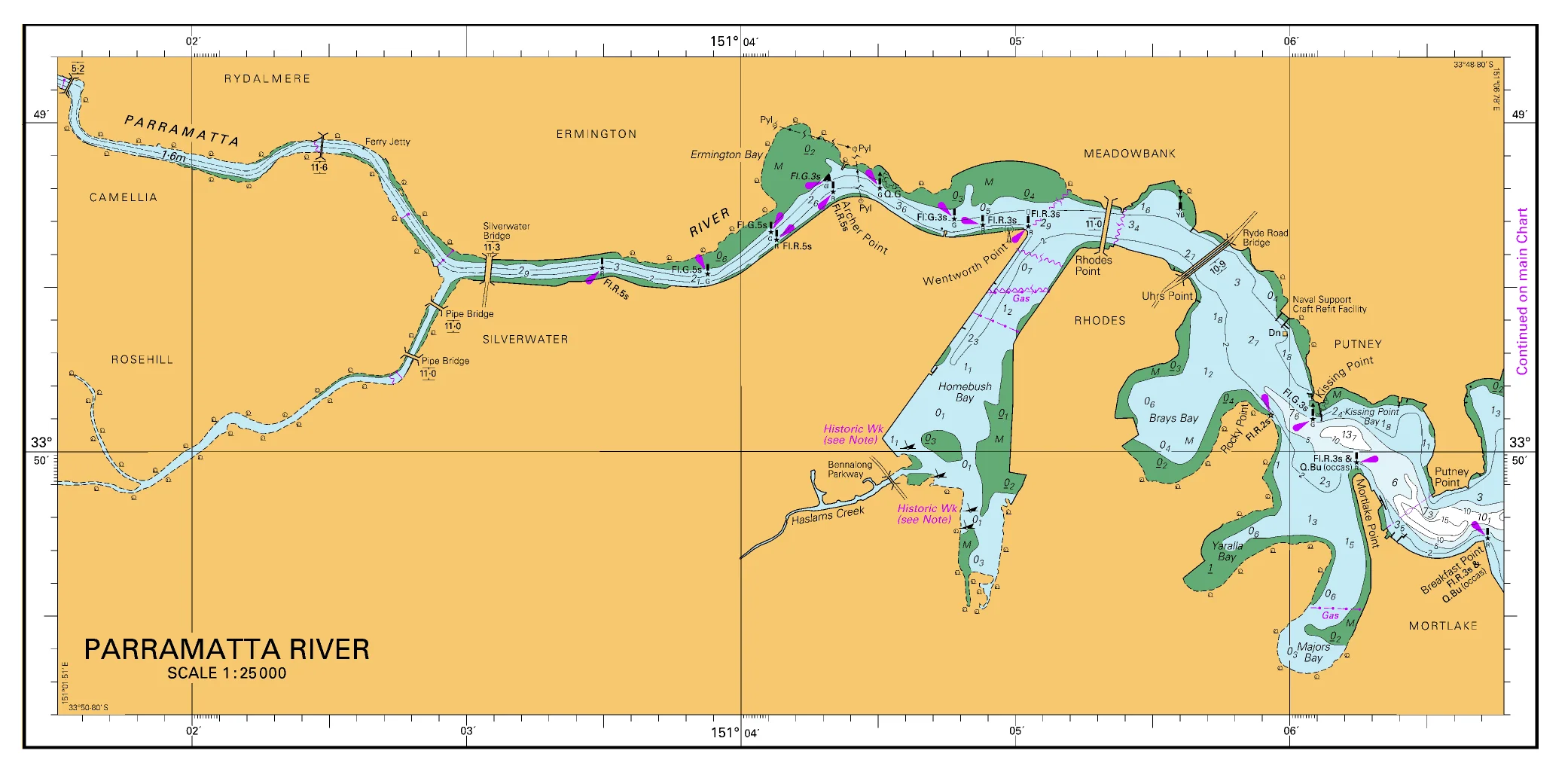
Skipper’s note: Pair with surrounding Whitsunday sheets (e.g., AUS 252) for broader context and anchorage detail.
Premium materials & finishes
-
Paper (120 gsm matte) — Crisp, flexible and chart-table friendly; ideal under nav-station glass.
-
Laminated (soft-matte front / gloss back, edge-sealed) — Low-glare, writeable face for notes and corrections; gloss back adds rigidity and wipes clean.
Skipper’s note: The soft-matte writeable face is specified so you can mark fixes, tide windows and lee-shore plans, then clean down between passages.
On-board & ashore use
-
🧭 Passage planning — Shape routes, tidal windows and landfall bearings.
-
⚓ Anchorage selection — Mark holding options and shelter from the trades.
-
📒 Crew briefings — At-a-glance layout for roles, calls and nav references.
-
🛠️ Club/charter office display — Durable laminated option for training rooms and briefings.
Specifications
| Field | Detail |
|---|---|
| Chart Number | AUS 253 (Aus253) |
| Title | Australia — East Coast — Queensland — Whitsunday Passage |
| Geographic Location | Australia |
| Scale (main) | 1:37,500 |
| Projection (main) | Mercator |
| North / South Limits | 20°11.73′ S / 20°25.00′ S |
| East / West Limits | 149°04.55′ E / 148°40.50′ E |
| Latest Edition | 08-Apr-2016 |
| Edition Number | 6 |
| Sheet Size | 1100 mm (W) × 770 mm (H) |
| Available Finishes | Paper (120 gsm matte); Laminated (soft-matte writeable front, gloss back, edge-sealed) |
| Inks | Pigment-based, fade-resistant |
| Origin | Printed in Australia |
Mariner’s guidance
Ideal for planning, briefing, education, and display. For navigation underway—especially near reefs and shifting sand—always carry and consult the latest official hydrographic chart or approved ECDIS with current Notices to Mariners and local guidance.
Explore Whitsunday Passage with confidence
Select your finish above and add to cart. We’ll print locally, hand-check, and ship with care.
Original: $49.95
-70%$49.95
$14.98

Description
AUS 253 — Whitsunday Passage, QLD Nautical Chart
For skippers, bareboat crews, and island-hopping cruisers threading the Whitsundays
Bring Whitsunday Passage into crisp, working focus. AUS 253 is the go-to planning and pilotage sheet for shaping legs between the mainland and the islands—ideal for plotting channels and leads, setting landfall bearings, and cueing anchorage options in trade-wind conditions.
Why skippers choose this chart
-
🧭 Passage planning made clear — Clean coastline detail for reliable bearings and confident briefings.
-
🪨 Reef & shoal awareness — Helpful for bommie avoidance, reef clearances, and lee-shore choices.
-
🌬️ Trade-wind friendly — Plan tacks, laylines, and tide gates through the Passage.
-
✍️ Write-on laminate option — Soft-matte face takes chart-correction/grease pencils cleanly.
-
🇦🇺 Printed in Australia — Colour-managed, hand-checked.
Coverage
-
Main Chart — AUS 253: Australia · East Coast · Queensland · Whitsunday Passage
-
Scale: 1:37,500 · Projection: Mercator
-
Bounds: N 20°11.73′ S · S 20°25.00′ S · E 149°04.55′ E · W 148°40.50′ E
-
Latest Edition: 08-Apr-2016
-
Skipper’s note: Pair with surrounding Whitsunday sheets (e.g., AUS 252) for broader context and anchorage detail.
Premium materials & finishes
-
Paper (120 gsm matte) — Crisp, flexible and chart-table friendly; ideal under nav-station glass.
-
Laminated (soft-matte front / gloss back, edge-sealed) — Low-glare, writeable face for notes and corrections; gloss back adds rigidity and wipes clean.
Skipper’s note: The soft-matte writeable face is specified so you can mark fixes, tide windows and lee-shore plans, then clean down between passages.
On-board & ashore use
-
🧭 Passage planning — Shape routes, tidal windows and landfall bearings.
-
⚓ Anchorage selection — Mark holding options and shelter from the trades.
-
📒 Crew briefings — At-a-glance layout for roles, calls and nav references.
-
🛠️ Club/charter office display — Durable laminated option for training rooms and briefings.
Specifications
| Field | Detail |
|---|---|
| Chart Number | AUS 253 (Aus253) |
| Title | Australia — East Coast — Queensland — Whitsunday Passage |
| Geographic Location | Australia |
| Scale (main) | 1:37,500 |
| Projection (main) | Mercator |
| North / South Limits | 20°11.73′ S / 20°25.00′ S |
| East / West Limits | 149°04.55′ E / 148°40.50′ E |
| Latest Edition | 08-Apr-2016 |
| Edition Number | 6 |
| Sheet Size | 1100 mm (W) × 770 mm (H) |
| Available Finishes | Paper (120 gsm matte); Laminated (soft-matte writeable front, gloss back, edge-sealed) |
| Inks | Pigment-based, fade-resistant |
| Origin | Printed in Australia |
Mariner’s guidance
Ideal for planning, briefing, education, and display. For navigation underway—especially near reefs and shifting sand—always carry and consult the latest official hydrographic chart or approved ECDIS with current Notices to Mariners and local guidance.
Explore Whitsunday Passage with confidence
Select your finish above and add to cart. We’ll print locally, hand-check, and ship with care.