1165 x 915mm | Ideal for Classrooms, Study Spaces & Global Awareness
Winkel Tripel Projection – Designed for Years 4–12
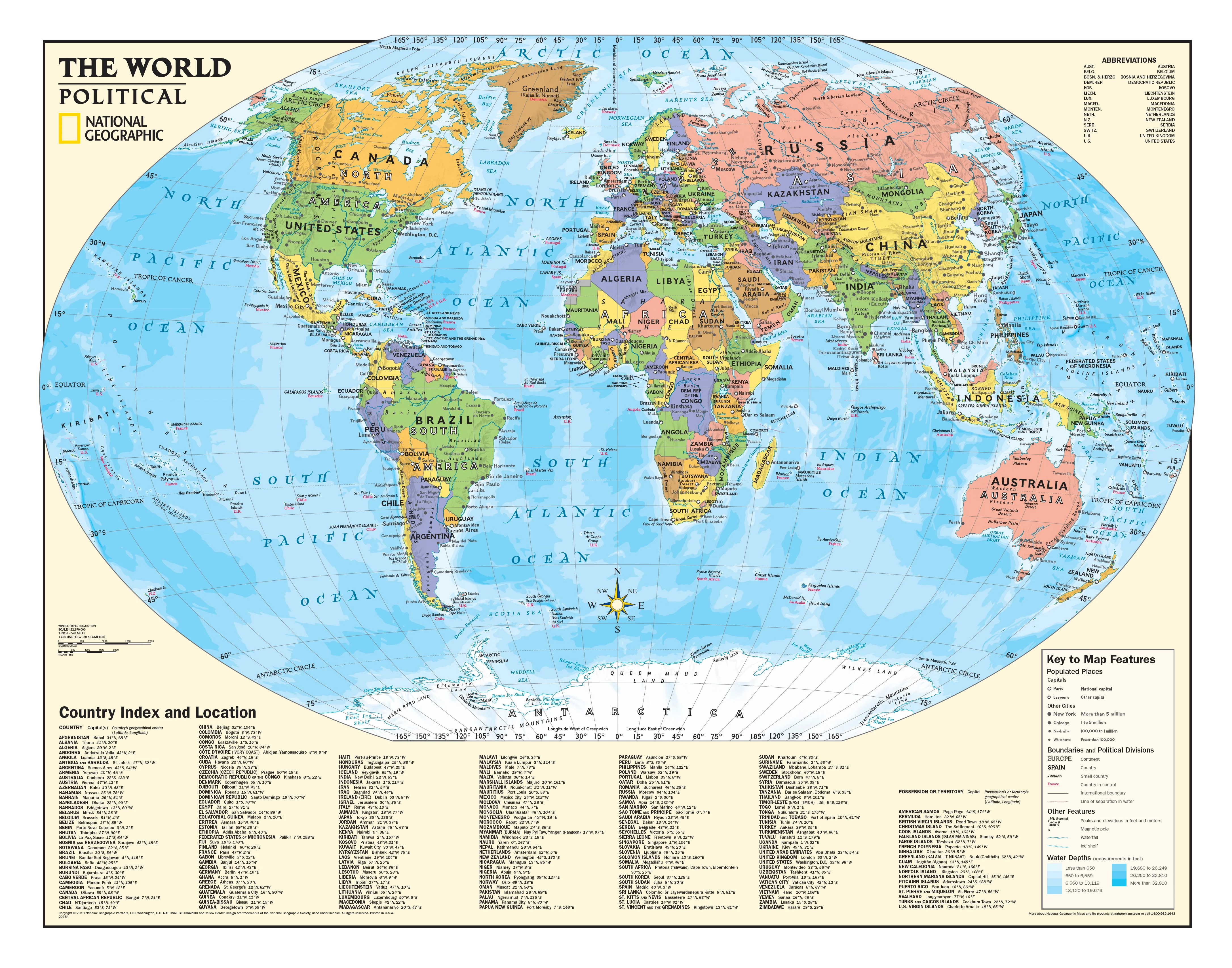
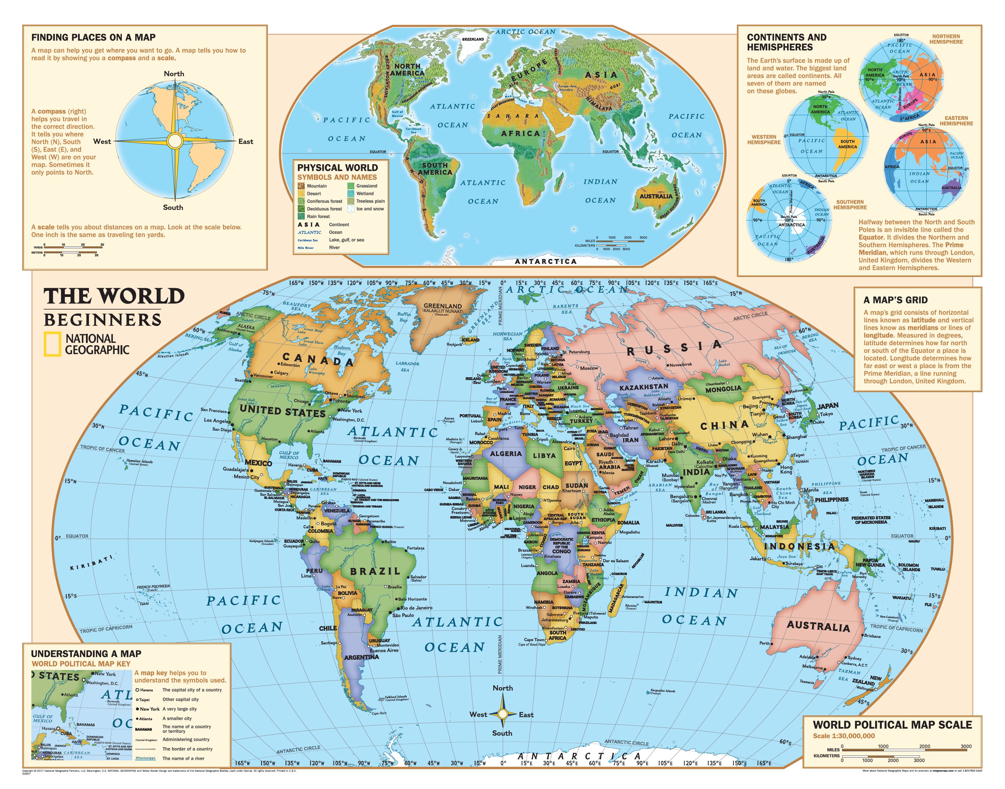
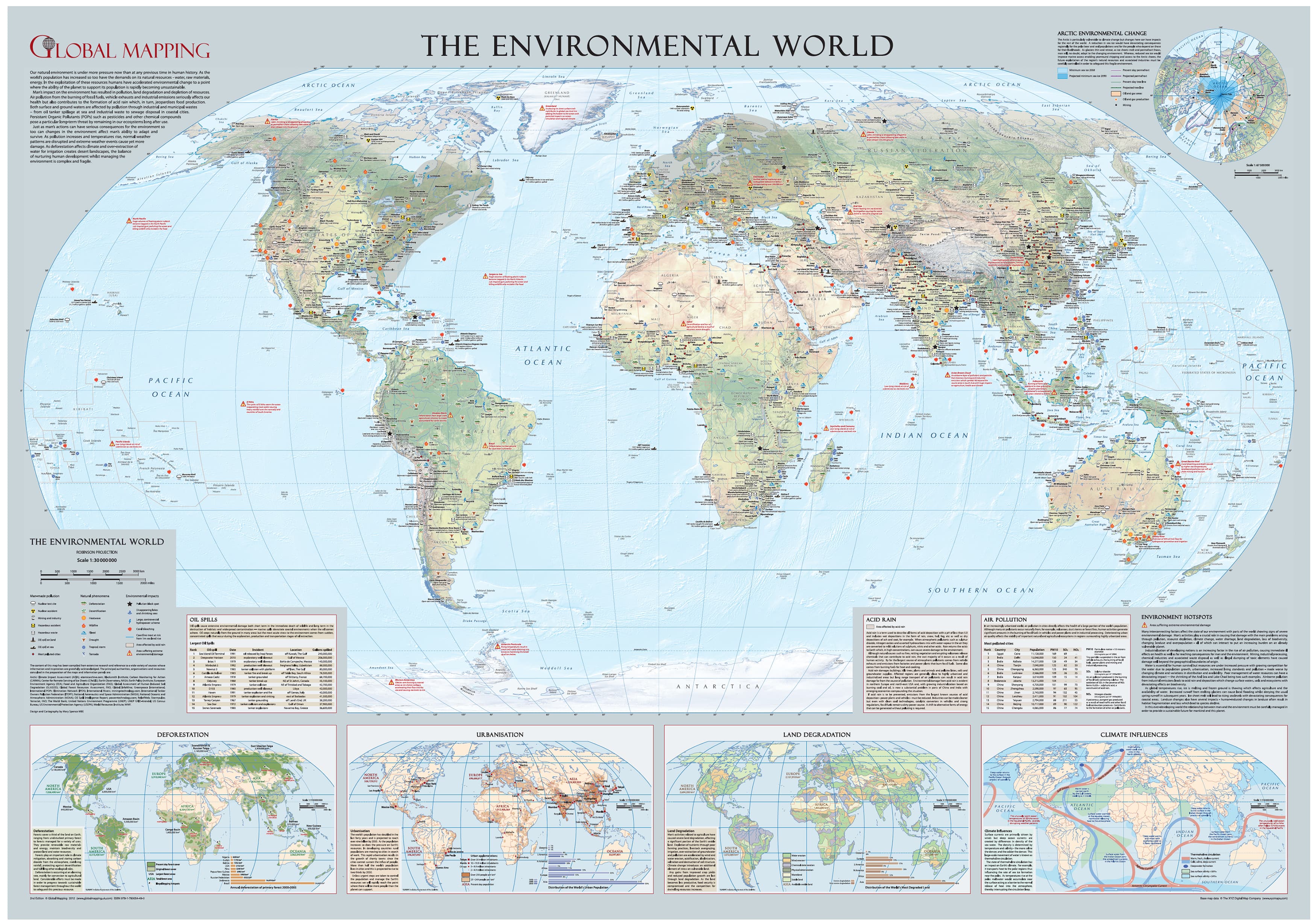
Bring geography to life with this political world wall map by National Geographic, specially designed for students from Years 4 through 12. Unlike conventional world maps that distort landmasses, this map uses the Winkel Tripel projection — considered the most accurate for classroom use — offering a realistic visual balance of area, shape, and distance.
Students and educators alike will benefit from a more faithful two-dimensional representation of the globe, where Greenland is no longer larger than South America and where continents appear in their proper proportion.
🗺️ Map Features
-
Up-to-date political boundaries and country names
-
Major cities and capitals
-
Easy-to-read labelling and colour-coded countries
-
Created by National Geographic, a name synonymous with educational excellence
-
Designed to promote spatial awareness and global literacy
🖨️ Available Finishes
| Finish Type | Details |
|---|---|
| Paper (160gsm) | Ideal for framing under glass |
| Laminated | True gloss encapsulation (2 × 80 micron layers), waterproof and writeable |
| Canvas (395gsm) | Printed on archival-grade HP Professional Matte Canvas with pigment-based inks – fade-resistant, durable, and richly detailed |
Optional Timber Hang Rails
For laminated & canvas versions, you may opt to include wooden hang rollers, top and bottom, in a natural lacquered finish, complete with a hanging cord on the top roller. It’s the simplest and most elegant way to display your map — just add a wall hook and you're done.
📦 Please allow 10 working days for delivery of hang-railed maps, as each is custom-finished by our framer.
📏 Specifications
| Specification | Detail |
|---|---|
| Publisher | National Geographic |
| Projection | Winkel Tripel |
| Scale | 1:32,970,000 |
| Size | 1165 mm (W) × 915 mm (H) |
| Published | 2018 |
| Made in | Australia |
🎓 Perfect For:
-
Primary & secondary school classrooms
-
Homeschooling environments
-
Offices, libraries, and study nooks
-
Parents and educators who want accurate geography at a glance
This is not just a map — it’s a powerful educational tool that helps students better understand the world and their place in it. Durable, attractive, and made to last, this wall map will become a lasting reference in any learning environment.