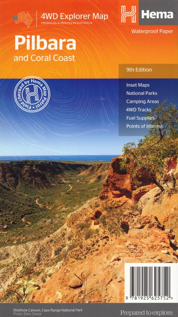
Roads & Tracks of Western Australia QPA 16th Edition
Same Day Shipping
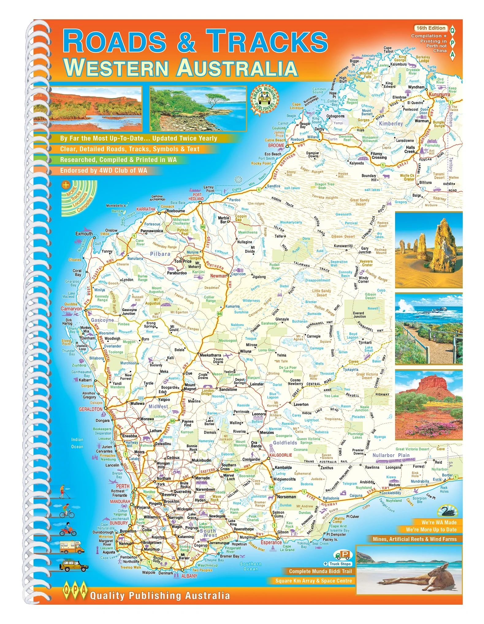
If you're planning to explore the diverse landscapes of Western Australia, the Roads & Tracks of Western Australia – 16th Edition by Quality Publishing Australia (QPA) is an indispensable resource. Published in September 2023, this spiral-bound A4 atlas offers detailed and up-to-date mapping, making it an essential companion for travellers, adventurers, and outdoor enthusiasts.
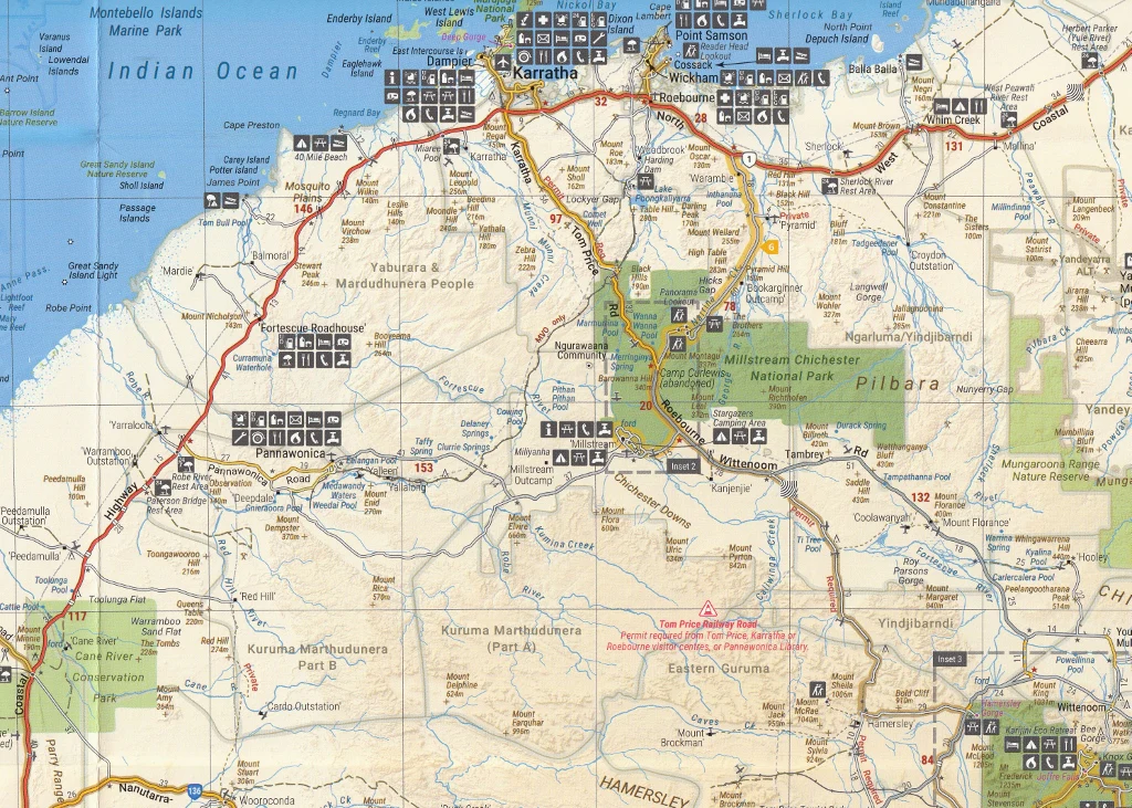
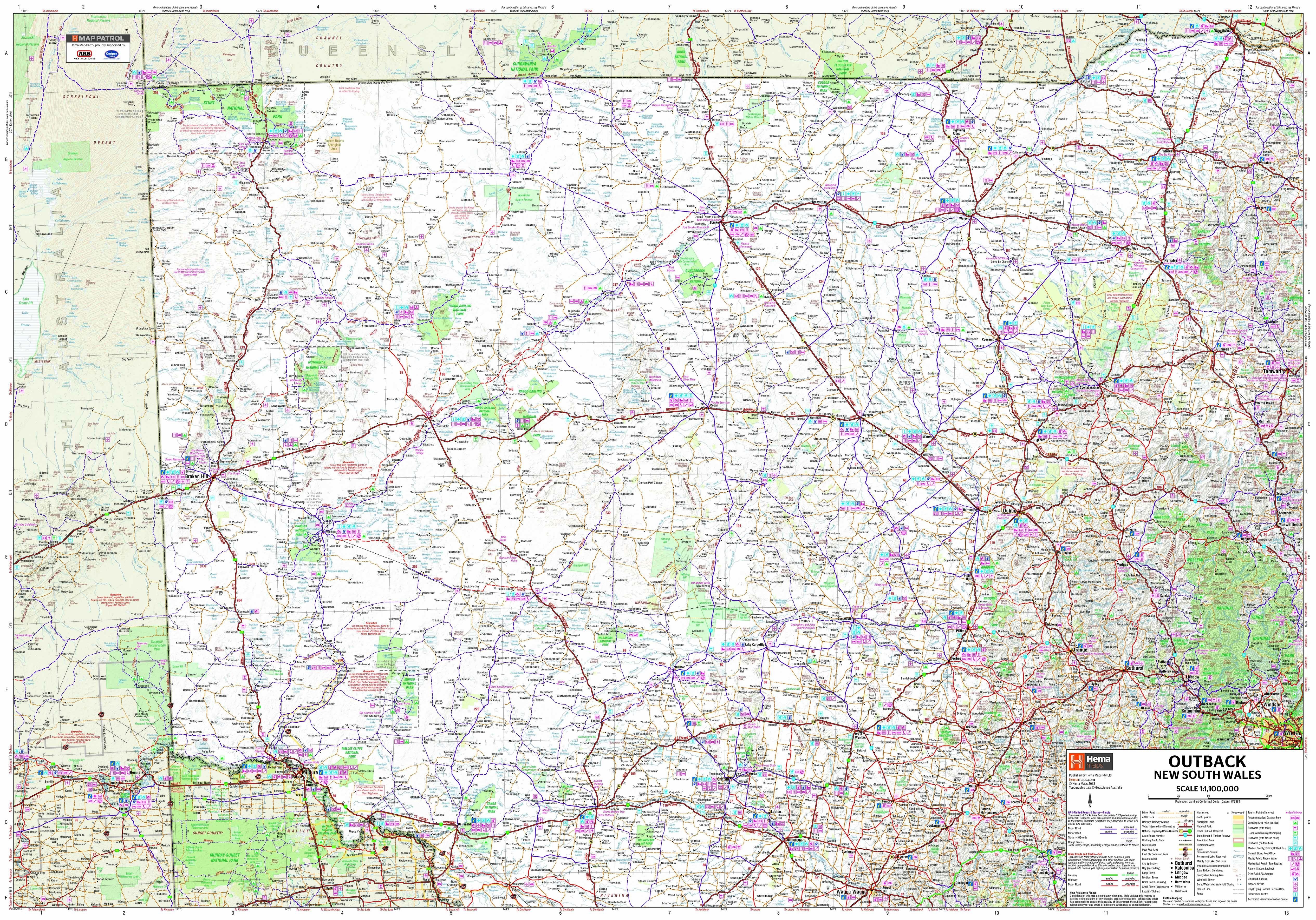
🗺️ Comprehensive Mapping Coverage
The atlas provides varying scales to suit different regions:
-
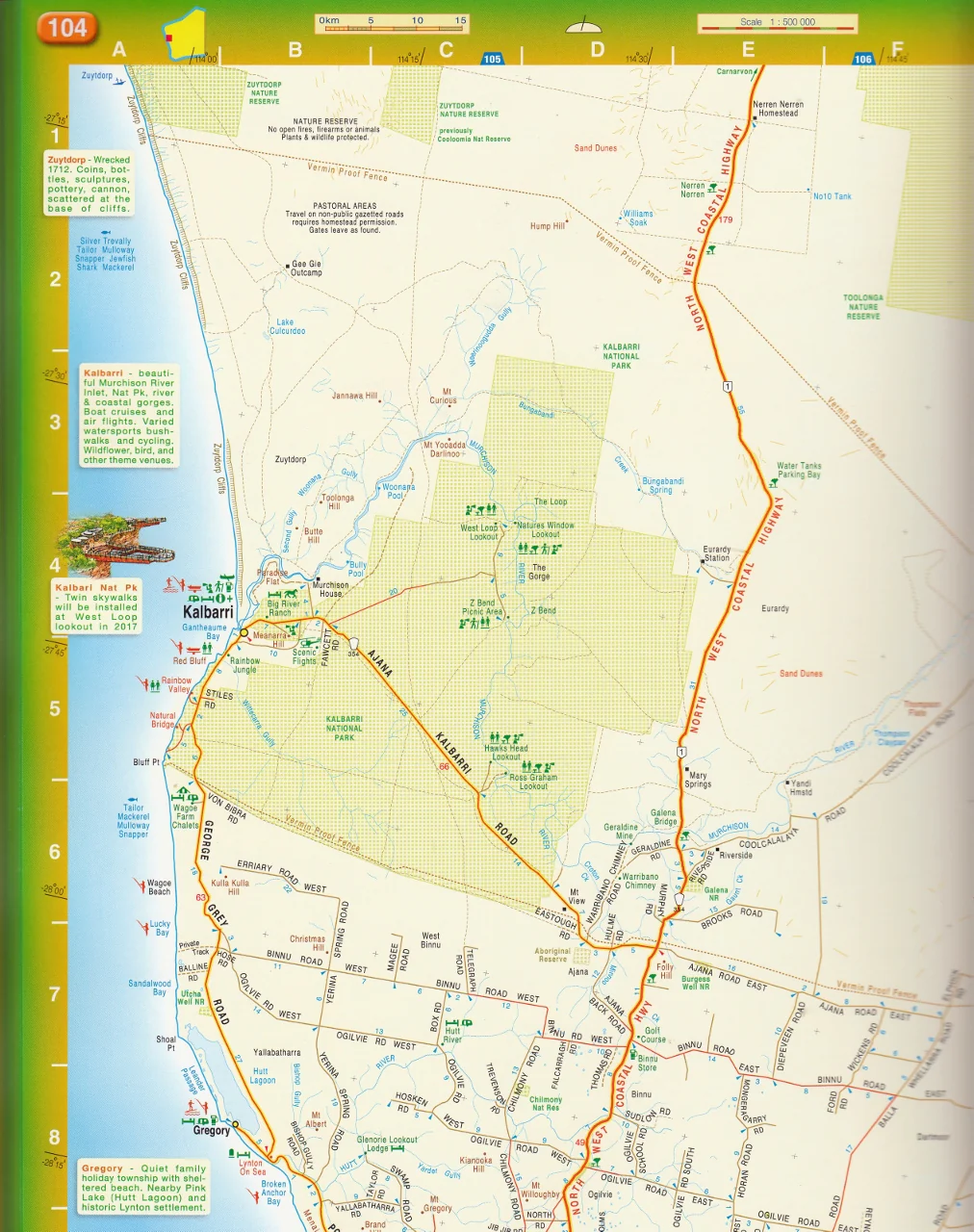
Southwest Region: Detailed at a 1:250,000 scale, covering areas such as Perth, Margaret River, and Albany.
-
Greater Southwest Area: Mapped at a 1:500,000 scale, extending beyond the immediate southwest.
-
Rest of the State: Presented at a 1:1,000,000 scale, encompassing the vast expanse of Western Australia.
This gradation ensures clarity and detail where needed, particularly in densely populated or frequently travelled areas.
🛣️ Detailed Road and Track Information
The atlas excels in its detailed representation of various routes:
-
Road Types: Includes major highways, minor roads, unsealed roads, old tracks, 4WD-only routes, and walking trails.
-
Intermediate Distances: Displays distances between key points on nearly every road, aiding in travel planning.
-
Topography: Utilises elevation tinting to depict the terrain, providing a visual understanding of the landscape.
🏕️ Points of Interest and Amenities
Beyond roadways, the atlas highlights numerous features to enhance your journey:
-
Attractions: Identifies various tourist attractions and natural landmarks.
-
Facilities: Marks fuel stops, accommodation options, campsites, rest areas, and fishing spots.
-
Perth Coverage: Includes several pages dedicated to Perth at various scales for urban navigation.
-
Flora and Fauna: Features illustrations showcasing the state's diverse plant and animal life.
-
Climate Data: Provides average monthly temperature and rainfall charts for various regions.
📖 Atlas Specifications
-
Format: Spiral-bound for ease of use.
-
Dimensions: 230 x 303 x 20 mm.
-
Weight: Approximately 1.3 kg.
-
Pages: 254 pages of detailed content.
-
Publication Date: September 2023.
📚 Additional Features
-
Index: An extensive index covering roads, places, geographical features, and national parks.
-
Local Production: Researched, compiled, and printed in Western Australia, ensuring local relevance and accuracy.
-
Endorsement: Endorsed by the 4WD Club of WA, reflecting its utility for off-road enthusiasts.
The QPA 16th Edition atlas is a valuable resource for travellers seeking a reliable and detailed guide to Western Australia's roads and tracks.
If you need further assistance or information on related mapping products, feel free to ask!


Description
Same Day Shipping
If you're planning to explore the diverse landscapes of Western Australia, the Roads & Tracks of Western Australia – 16th Edition by Quality Publishing Australia (QPA) is an indispensable resource. Published in September 2023, this spiral-bound A4 atlas offers detailed and up-to-date mapping, making it an essential companion for travellers, adventurers, and outdoor enthusiasts.
🗺️ Comprehensive Mapping Coverage
The atlas provides varying scales to suit different regions:
-
Southwest Region: Detailed at a 1:250,000 scale, covering areas such as Perth, Margaret River, and Albany.
-
Greater Southwest Area: Mapped at a 1:500,000 scale, extending beyond the immediate southwest.
-
Rest of the State: Presented at a 1:1,000,000 scale, encompassing the vast expanse of Western Australia.
This gradation ensures clarity and detail where needed, particularly in densely populated or frequently travelled areas.
🛣️ Detailed Road and Track Information
The atlas excels in its detailed representation of various routes:
-
Road Types: Includes major highways, minor roads, unsealed roads, old tracks, 4WD-only routes, and walking trails.
-
Intermediate Distances: Displays distances between key points on nearly every road, aiding in travel planning.
-
Topography: Utilises elevation tinting to depict the terrain, providing a visual understanding of the landscape.
🏕️ Points of Interest and Amenities
Beyond roadways, the atlas highlights numerous features to enhance your journey:
-
Attractions: Identifies various tourist attractions and natural landmarks.
-
Facilities: Marks fuel stops, accommodation options, campsites, rest areas, and fishing spots.
-
Perth Coverage: Includes several pages dedicated to Perth at various scales for urban navigation.
-
Flora and Fauna: Features illustrations showcasing the state's diverse plant and animal life.
-
Climate Data: Provides average monthly temperature and rainfall charts for various regions.
📖 Atlas Specifications
-
Format: Spiral-bound for ease of use.
-
Dimensions: 230 x 303 x 20 mm.
-
Weight: Approximately 1.3 kg.
-
Pages: 254 pages of detailed content.
-
Publication Date: September 2023.
📚 Additional Features
-
Index: An extensive index covering roads, places, geographical features, and national parks.
-
Local Production: Researched, compiled, and printed in Western Australia, ensuring local relevance and accuracy.
-
Endorsement: Endorsed by the 4WD Club of WA, reflecting its utility for off-road enthusiasts.
The QPA 16th Edition atlas is a valuable resource for travellers seeking a reliable and detailed guide to Western Australia's roads and tracks.
If you need further assistance or information on related mapping products, feel free to ask!