Ukraine Moldova Gizi Maps Folded
Single-Sided Travel & Terrain Map | Scale: 1:1,000,000
Covers Both Ukraine and Moldova | Includes Place Name Index
Size: 1000 mm x 930 mm | Print-on-Demand – Please Allow 10 Working Days for Delivery
🌍 Explore the Crossroads of Eastern Europe with Confidence
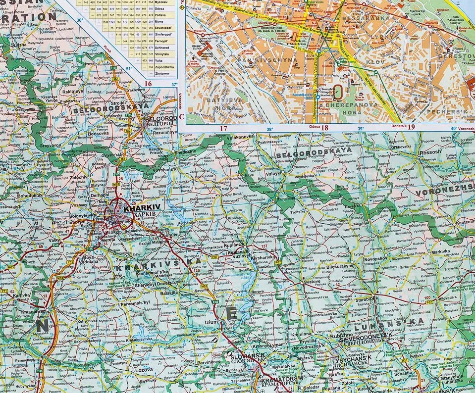
Discover the vast landscapes, historical towns, and evolving regions of Ukraine and Moldova with this detailed, single-sided map by Gizi Maps. Designed for both travellers and researchers, this map combines precise road detail, topographic shading, and cultural points of interest in one beautifully rendered sheet at a practical 1:1,100,000 scale.
Whether you're tracing the Carpathian Mountains, navigating between major cities, or planning a journey through rural countryside and border regions, this map offers a clear and comprehensive guide.
🧭 Key Features
✅ Complete Coverage of Ukraine & Moldova
-
Shows all major cities, towns, villages, and geographical features
-
Includes capital cities Kyiv (Kiev) and Chișinău, as well as regional hubs like Odesa, Lviv, Dnipro, Tiraspol, and Chernivtsi
-
Borders with Poland, Romania, Russia, Hungary, Belarus, and Slovakia clearly marked
✅ Road & Transport Network
-
Clearly delineated motorways, national and regional roads, and minor rural routes
-
Distances between key locations marked along major roads
-
Includes railway lines and major border crossings
✅ Topography & Natural Features
-
Colour-shaded elevation and spot heights highlight mountainous areas, valleys, plains, and coastlines
-
Rivers, lakes, and natural reserves accurately represented
-
Great for planning outdoor adventures or understanding geographic context
✅ Tourist & Cultural Points of Interest
-
Map symbols mark important sites such as:
-
🏰 Castles, churches, and historic monuments
-
🏞️ National parks, protected areas, and reserves
-
🏨 Tourist services, cultural landmarks, and accommodations
-
✅ Place Name Index
-
Extensive index of towns, cities, and physical features included for quick reference and route planning
📐 Specifications at a Glance
| Feature | Details |
|---|---|
| Map Type | Folded, single-sided travel and terrain map |
| Publisher | Gizi Maps |
| Scale | 1:1,100,000 |
| Coverage | Entire countries of Ukraine & Moldova |
| Size (Unfolded) | 1000 mm x 930 mm (approx. 39.4" x 36.6") |
| Topography | Colour shading, gradient tints, spot heights |
| Tourism Symbols | Yes – historic sites, services, and natural landmarks |
| Place Name Index | Included |
| Language | English (legend and place names) |
| Format | Folded map |
| Material | High-quality paper |
👥 Who Is This Map For?
-
🚗 Independent travellers and road trippers exploring Eastern Europe
-
🗺️ Researchers, educators, and students studying the geography and borders of the region
-
🧭 Adventure travellers planning routes through the Carpathians, Black Sea region, or Transnistria
-
📚 Historians and cultural tourists visiting UNESCO sites and heritage towns
-
🗺️ Map collectors looking for detailed, high-quality Central and Eastern European coverage
🕒 Ordered on Demand – Please Allow Extra Time for Delivery
📦 This map is ordered on demand from the publisher - Please allow up to 10 working days for dispatch.
🛒 Add the Ukraine & Moldova Gizi Map to Your Cart Today
A richly detailed and practical guide to two of Eastern Europe’s most fascinating and historically complex countries—ideal for travellers, planners, and curious minds.
Original: $29.95
-70%$29.95
$8.98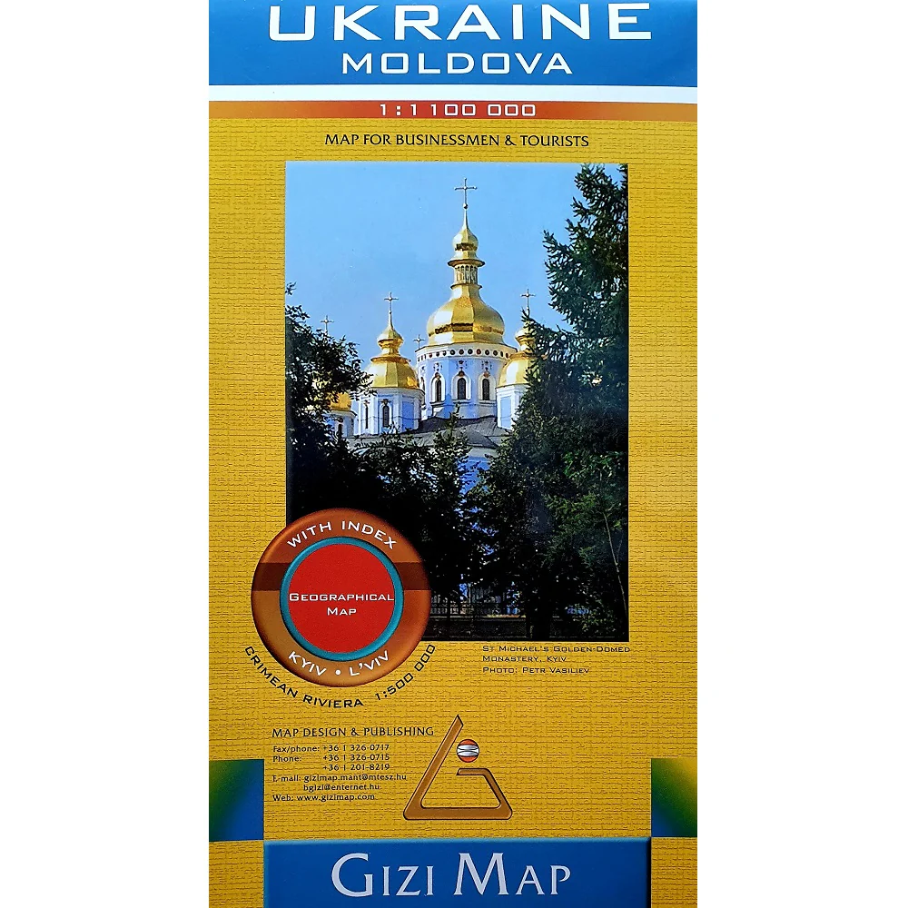

Description
Single-Sided Travel & Terrain Map | Scale: 1:1,000,000
Covers Both Ukraine and Moldova | Includes Place Name Index
Size: 1000 mm x 930 mm | Print-on-Demand – Please Allow 10 Working Days for Delivery
🌍 Explore the Crossroads of Eastern Europe with Confidence
Discover the vast landscapes, historical towns, and evolving regions of Ukraine and Moldova with this detailed, single-sided map by Gizi Maps. Designed for both travellers and researchers, this map combines precise road detail, topographic shading, and cultural points of interest in one beautifully rendered sheet at a practical 1:1,100,000 scale.
Whether you're tracing the Carpathian Mountains, navigating between major cities, or planning a journey through rural countryside and border regions, this map offers a clear and comprehensive guide.
🧭 Key Features
✅ Complete Coverage of Ukraine & Moldova
-
Shows all major cities, towns, villages, and geographical features
-
Includes capital cities Kyiv (Kiev) and Chișinău, as well as regional hubs like Odesa, Lviv, Dnipro, Tiraspol, and Chernivtsi
-
Borders with Poland, Romania, Russia, Hungary, Belarus, and Slovakia clearly marked
✅ Road & Transport Network
-
Clearly delineated motorways, national and regional roads, and minor rural routes
-
Distances between key locations marked along major roads
-
Includes railway lines and major border crossings
✅ Topography & Natural Features
-
Colour-shaded elevation and spot heights highlight mountainous areas, valleys, plains, and coastlines
-
Rivers, lakes, and natural reserves accurately represented
-
Great for planning outdoor adventures or understanding geographic context
✅ Tourist & Cultural Points of Interest
-
Map symbols mark important sites such as:
-
🏰 Castles, churches, and historic monuments
-
🏞️ National parks, protected areas, and reserves
-
🏨 Tourist services, cultural landmarks, and accommodations
-
✅ Place Name Index
-
Extensive index of towns, cities, and physical features included for quick reference and route planning
📐 Specifications at a Glance
| Feature | Details |
|---|---|
| Map Type | Folded, single-sided travel and terrain map |
| Publisher | Gizi Maps |
| Scale | 1:1,100,000 |
| Coverage | Entire countries of Ukraine & Moldova |
| Size (Unfolded) | 1000 mm x 930 mm (approx. 39.4" x 36.6") |
| Topography | Colour shading, gradient tints, spot heights |
| Tourism Symbols | Yes – historic sites, services, and natural landmarks |
| Place Name Index | Included |
| Language | English (legend and place names) |
| Format | Folded map |
| Material | High-quality paper |
👥 Who Is This Map For?
-
🚗 Independent travellers and road trippers exploring Eastern Europe
-
🗺️ Researchers, educators, and students studying the geography and borders of the region
-
🧭 Adventure travellers planning routes through the Carpathians, Black Sea region, or Transnistria
-
📚 Historians and cultural tourists visiting UNESCO sites and heritage towns
-
🗺️ Map collectors looking for detailed, high-quality Central and Eastern European coverage
🕒 Ordered on Demand – Please Allow Extra Time for Delivery
📦 This map is ordered on demand from the publisher - Please allow up to 10 working days for dispatch.
🛒 Add the Ukraine & Moldova Gizi Map to Your Cart Today
A richly detailed and practical guide to two of Eastern Europe’s most fascinating and historically complex countries—ideal for travellers, planners, and curious minds.