Virgin Islands Borch Folded Laminated Map
Includes US & British Virgin Islands | Waterproof, Wipeable, Folded Map
Scale: 1:80,000 | Sheet Size: 880 mm x 494 mm | 5th Edition (2014)
📦 Order on Demand – Please Allow 10 Working Days for Delivery
🏝️ Explore the Caribbean’s Island Paradise with Confidence
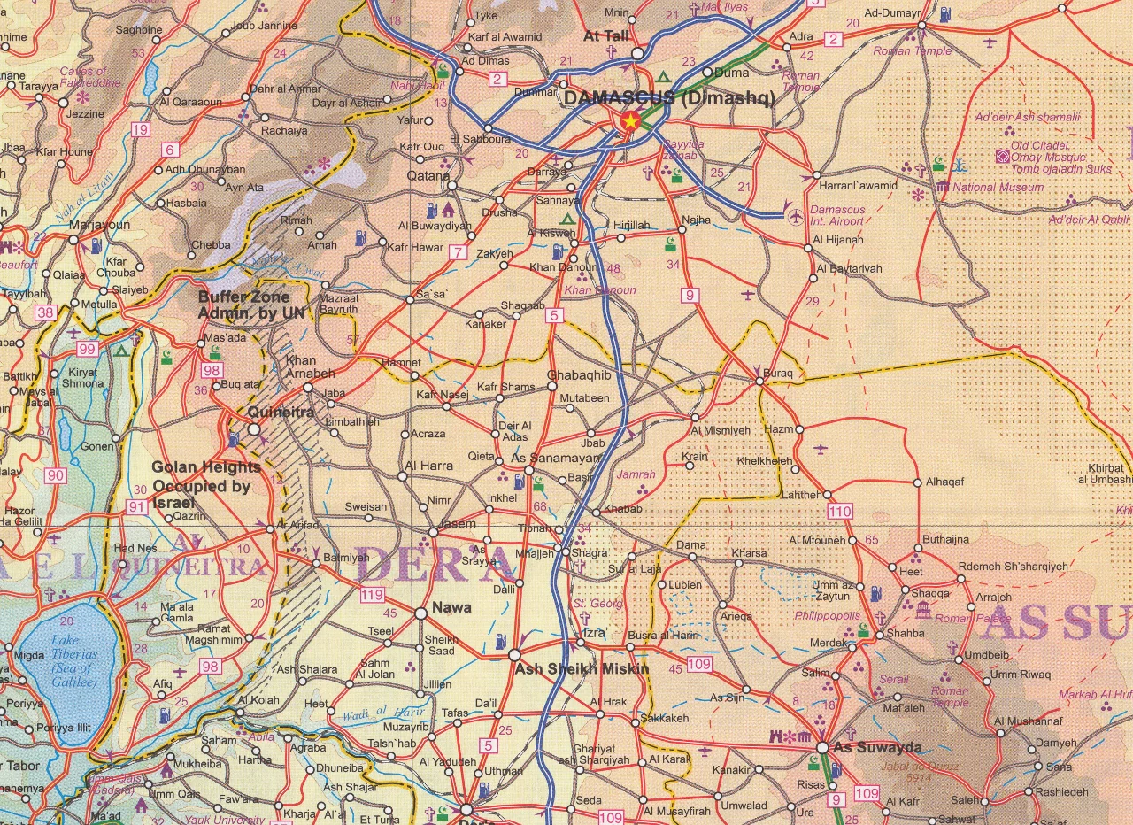
This beautifully designed folded, laminated travel map of the Virgin Islands from Borch Maps offers a highly detailed, easy-to-read overview of both the U.S. Virgin Islands and British Virgin Islands. Whether you're cruising through the Lesser Antilles, exploring historic Charlotte Amalie, or planning a beach escape to Tortola or St. Croix, this map is your ideal companion.
Waterproof, tear-resistant, and soft-laminated for daily use, this durable travel map is perfect for island hopping, itinerary planning, or displaying as a vibrant reference.
🗺️ Coverage & Map Details
Main Map Scales:
-
🇻🇮 U.S. Virgin Islands – 1:80,000
-
🇬🇧 British Virgin Islands – 1:80,000
-
St. Croix, Anegada, Tobago Islands – 1:80,000
-
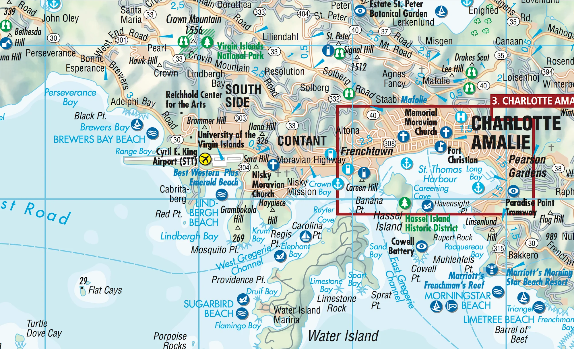
Charlotte Amalie, Cruz Bay, Christiansted, Frederiksted, Road Town, The Valley – 1:15,000
-
Charlotte Amalie Historic District – 1:7,500
-
Lesser Antilles overview – 1:7,000,000
-
Virgin Islands Administrative & Time Zones map
🌟 Key Features
✅ Durable & Weather-Resistant
-
Soft-laminated for wipe-clean usability
-
Water-repellent and tear-resistant—ideal for humid and tropical climates
✅ Detailed & Accurate Cartography
-
Road networks, urban street maps, and ferry routes
-
Top sights, public transport stops, museums, markets, beaches, and marinas
✅ Tourist-Focused Insets
-
Easy-to-navigate city plans for Charlotte Amalie, Christiansted, Cruz Bay, The Valley, and more
-
Administrative and timezone overlays for regional context
✅ Helpful Travel Data
-
🌡️ Climate charts: temperatures, sunshine hours, humidity, and rainfall
-
📐 Conversion charts for weights, measures, and temperatures
-
🏨 Points of interest including hotels, cultural sites, and shopping areas
📐 Specifications
| Feature | Details |
|---|---|
| Publisher | Borch Maps |
| Edition | 5th Edition (2014) |
| Scale | 1:80,000 (main maps) |
| Size (Unfolded) | 880 mm x 494 mm |
| Folded Size | 243 mm (H) x 110 mm (W) x 8 mm (D) |
| Weight | 71 g (2.5 oz) |
| Material | Soft-laminated, durable card stock |
| ISBN | 978-3-86609-517-5 |
🌴 A Snapshot of Island Life
The Virgin Islands archipelago lies east of Puerto Rico, nestled between the Caribbean Sea and the Atlantic Ocean. Divided into two political regions—the U.S. Virgin Islands (St. Thomas, St. John, St. Croix) and the British Virgin Islands (Tortola, Virgin Gorda, Anegada, Jost Van Dyke)—this lush, tropical paradise is known for its:
-
🌺 Year-round balmy climate and trade winds
-
⛰️ Rugged terrain and stunning coastal views
-
🐠 Vibrant marine life and coral reefs
-
🏖️ Pristine white-sand beaches
-
🧭 Rich colonial and maritime history
👥 Perfect For:
-
✈️ Travellers and cruisers exploring the Caribbean islands
-
🗺️ Map collectors and island lovers
-
📚 Teachers, planners, and researchers of the Caribbean region
-
🌊 Beachgoers, divers, and sailors navigating the Virgin Islands
🛒 Add This Island Essential to Your Cart
Whether you're visiting for the beaches, the culture, or the history, this Virgin Islands Folded Map by Borch offers the clarity, detail, and durability you need to make the most of your Caribbean adventure.
📦 Please Note: This is an Order on Demand product. Kindly allow up to 10 working days for delivery
Original: $21.95
-70%$21.95
$6.58


Description
Includes US & British Virgin Islands | Waterproof, Wipeable, Folded Map
Scale: 1:80,000 | Sheet Size: 880 mm x 494 mm | 5th Edition (2014)
📦 Order on Demand – Please Allow 10 Working Days for Delivery
🏝️ Explore the Caribbean’s Island Paradise with Confidence
This beautifully designed folded, laminated travel map of the Virgin Islands from Borch Maps offers a highly detailed, easy-to-read overview of both the U.S. Virgin Islands and British Virgin Islands. Whether you're cruising through the Lesser Antilles, exploring historic Charlotte Amalie, or planning a beach escape to Tortola or St. Croix, this map is your ideal companion.
Waterproof, tear-resistant, and soft-laminated for daily use, this durable travel map is perfect for island hopping, itinerary planning, or displaying as a vibrant reference.
🗺️ Coverage & Map Details
Main Map Scales:
-
🇻🇮 U.S. Virgin Islands – 1:80,000
-
🇬🇧 British Virgin Islands – 1:80,000
-
St. Croix, Anegada, Tobago Islands – 1:80,000
-
Charlotte Amalie, Cruz Bay, Christiansted, Frederiksted, Road Town, The Valley – 1:15,000
-
Charlotte Amalie Historic District – 1:7,500
-
Lesser Antilles overview – 1:7,000,000
-
Virgin Islands Administrative & Time Zones map
🌟 Key Features
✅ Durable & Weather-Resistant
-
Soft-laminated for wipe-clean usability
-
Water-repellent and tear-resistant—ideal for humid and tropical climates
✅ Detailed & Accurate Cartography
-
Road networks, urban street maps, and ferry routes
-
Top sights, public transport stops, museums, markets, beaches, and marinas
✅ Tourist-Focused Insets
-
Easy-to-navigate city plans for Charlotte Amalie, Christiansted, Cruz Bay, The Valley, and more
-
Administrative and timezone overlays for regional context
✅ Helpful Travel Data
-
🌡️ Climate charts: temperatures, sunshine hours, humidity, and rainfall
-
📐 Conversion charts for weights, measures, and temperatures
-
🏨 Points of interest including hotels, cultural sites, and shopping areas
📐 Specifications
| Feature | Details |
|---|---|
| Publisher | Borch Maps |
| Edition | 5th Edition (2014) |
| Scale | 1:80,000 (main maps) |
| Size (Unfolded) | 880 mm x 494 mm |
| Folded Size | 243 mm (H) x 110 mm (W) x 8 mm (D) |
| Weight | 71 g (2.5 oz) |
| Material | Soft-laminated, durable card stock |
| ISBN | 978-3-86609-517-5 |
🌴 A Snapshot of Island Life
The Virgin Islands archipelago lies east of Puerto Rico, nestled between the Caribbean Sea and the Atlantic Ocean. Divided into two political regions—the U.S. Virgin Islands (St. Thomas, St. John, St. Croix) and the British Virgin Islands (Tortola, Virgin Gorda, Anegada, Jost Van Dyke)—this lush, tropical paradise is known for its:
-
🌺 Year-round balmy climate and trade winds
-
⛰️ Rugged terrain and stunning coastal views
-
🐠 Vibrant marine life and coral reefs
-
🏖️ Pristine white-sand beaches
-
🧭 Rich colonial and maritime history
👥 Perfect For:
-
✈️ Travellers and cruisers exploring the Caribbean islands
-
🗺️ Map collectors and island lovers
-
📚 Teachers, planners, and researchers of the Caribbean region
-
🌊 Beachgoers, divers, and sailors navigating the Virgin Islands
🛒 Add This Island Essential to Your Cart
Whether you're visiting for the beaches, the culture, or the history, this Virgin Islands Folded Map by Borch offers the clarity, detail, and durability you need to make the most of your Caribbean adventure.
📦 Please Note: This is an Order on Demand product. Kindly allow up to 10 working days for delivery