West Central Africa Atlas of the World, 11th Edition, National Geographic Wall Map
National Geographic | Atlas of the World, 11th Edition
📐 Sizes: Standard – 790 × 610 mm | Supermap – 915 × 1197 mm
📚 Published: 2019
Rich in detail. Built for clarity. Designed to inspire.
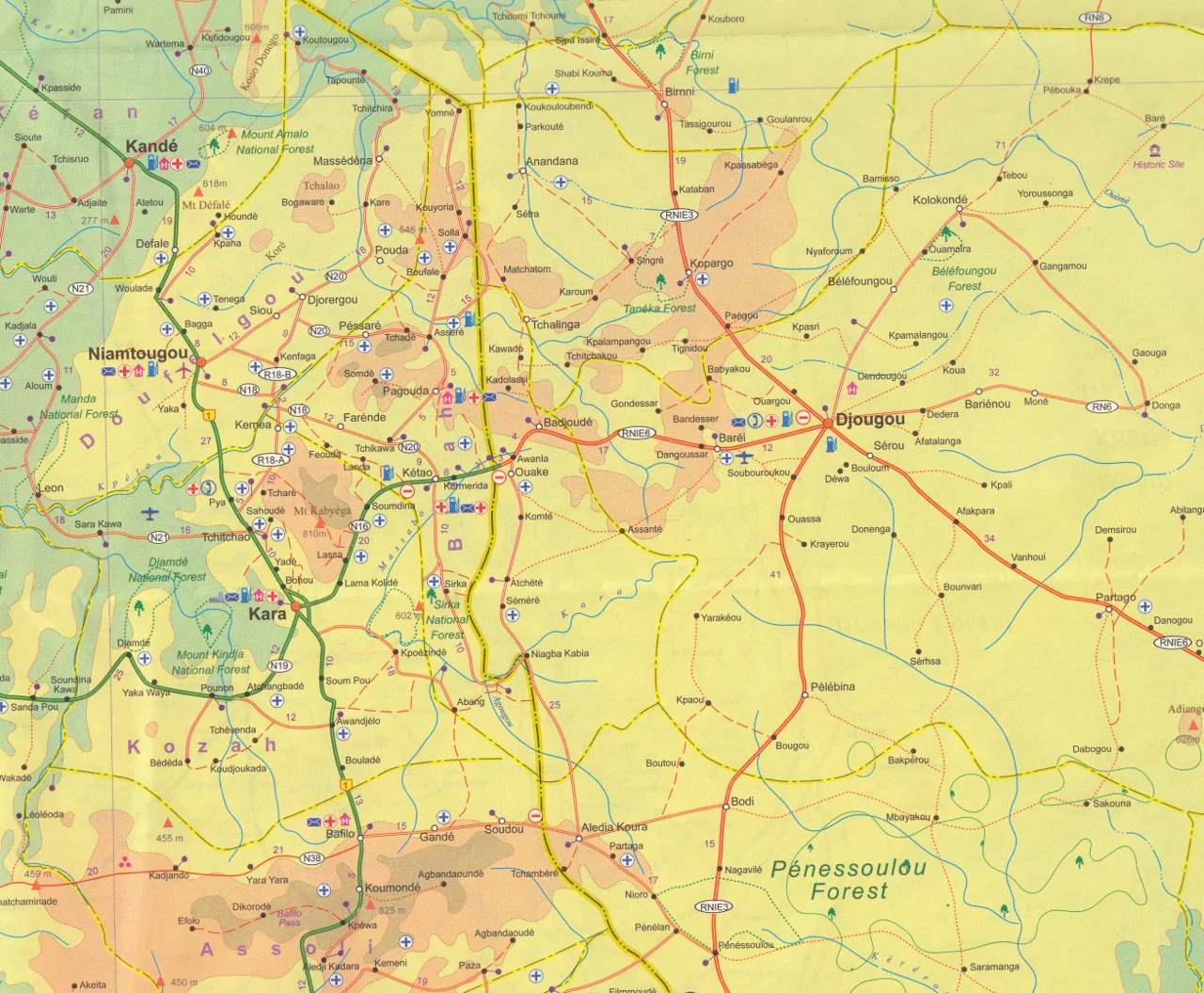
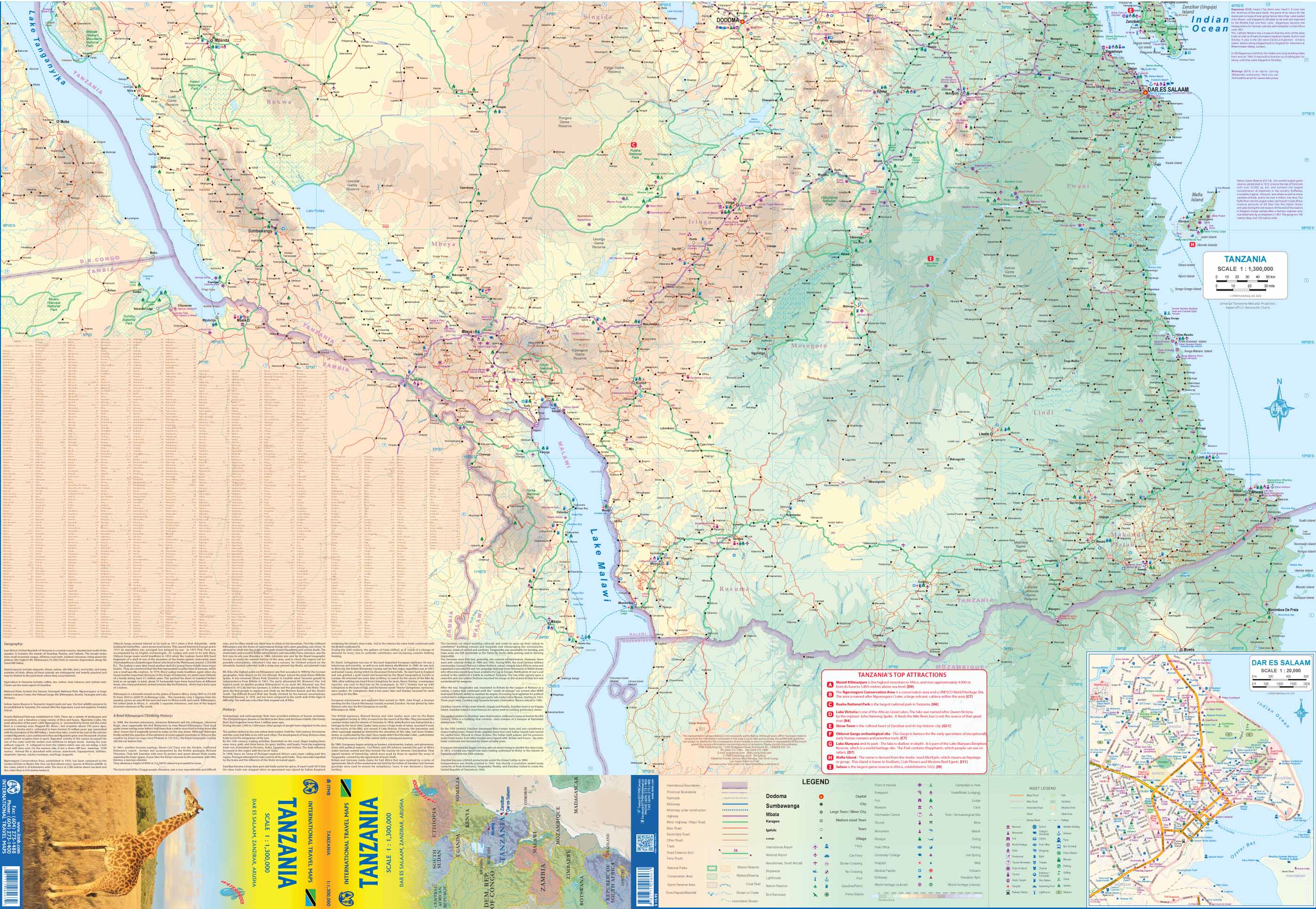
Bring the vibrant landscapes, diverse cultures, and complex geography of West Central Africa to your wall with this stunning wall map from National Geographic’s 11th Edition Atlas of the World. Combining political boundaries and physical features in a single, beautifully balanced design, this map is an exceptional visual resource—ideal for classrooms, libraries, offices, and study spaces.
Whether you're tracing river systems, exploring national borders, or understanding topography, this map delivers educational clarity and decorative appeal in equal measure.
🌍 What the Map Covers
This regional map captures a sweeping portion of Central Africa’s western interior, a region defined by rivers, rainforests, highlands, and a rich colonial legacy. Key countries include:
-
🇨🇲 Cameroon
-
🇨🇬 Republic of the Congo
-
🇨🇫 Central African Republic
-
🇬🇦 Gabon
-
🇬🇶 Equatorial Guinea
-
🇨🇩 Democratic Republic of the Congo (western portion)
-
🇦🇴 Angola (northeastern portion)
🗺️ Map Highlights
| Feature | Description |
|---|---|
| 🌐 Political Detail | Clearly marked international borders and national capitals |
| 🏞️ Physical Geography | Shaded relief shows elevation, rivers, basins, mountains, and coastline |
| 🌊 Hydrography | Congo River system, Gulf of Guinea, Lake Chad region |
| 📌 Legible Labelling | Carefully placed names of countries, cities, rivers, and natural features |
| 🗺️ Projection | Transverse Mercator – ideal for proportional distances and geographical accuracy |
| 🖌️ Design Aesthetic | Bright, colour-blind-friendly palette with National Geographic’s signature style |
🖼️ Display Options & Finishes
Choose the perfect format for your space and usage:
| Format | Details |
|---|---|
| 🖨️ Paper | 160gsm heavyweight matte paper – ideal for framing under glass |
| 💧 Laminated | Gloss-laminated front and back (80 micron) – waterproof and marker-friendly |
| 🖼️ Canvas | 395gsm HP Professional Matte Canvas – fade-resistant, textured finish |
| 🪵 Laminated + Hang Rails | Laminated map with top and bottom natural timber hang rails, satin lacquer |
| 🪵 Canvas + Hang Rails | Canvas map with timber rails for a gallery-quality, ready-to-hang look |
All hang rail versions include a top cord for easy hanging and are hand-finished by our professional framer.
🕰️ Please allow up to 10 working days for delivery of hang-railed maps.
📐 Map Specifications
| Attribute | Detail |
|---|---|
| Publisher | National Geographic |
| Edition | 11th Edition Atlas of the World |
| Publication Year | 2019 |
| Projection | Transverse Mercator |
| Style | Political + Physical |
| Sizes Available | Standard: 790 × 610 mm Supermap: 915 × 1197 mm |
| Print Origin | Printed and finished in Australia |
| Optional Extras | Timber hang rails for laminated and canvas formats |
💡 Why Choose This Map?
✅ World-Class Cartography – From one of the most trusted names in global mapping
✅ Dual Purpose Design – Equally suitable for education and elegant display
✅ Insightful Geography – Highlights West Central Africa’s natural and human landscape
✅ High-Quality Materials – Designed to last, whether mounted, framed, or rolled
✅ Versatile Formats – From classrooms to conference rooms, we’ve got you covered
🎯 Perfect For:
-
📚 Classrooms & Geography Departments – Teach borders, environments, and regional context
-
🏛️ Offices & Embassies – Showcase a strategic region with clarity and beauty
-
🧭 Travellers & Researchers – Gain insight into one of Africa’s most biodiverse regions
-
🎁 Gifts for Map Lovers – A thoughtful and practical present
🛒 Add to Your Wall – Explore West Central Africa
This West Central Africa Wall Map offers more than information—it offers inspiration. A celebration of natural beauty, political geography, and world-class design, it brings knowledge and elegance to every wall.
Order yours today in the format that suits your space, and experience the power of maps done right.
Original: $69.95
-70%$69.95
$20.98
Description
National Geographic | Atlas of the World, 11th Edition
📐 Sizes: Standard – 790 × 610 mm | Supermap – 915 × 1197 mm
📚 Published: 2019
Rich in detail. Built for clarity. Designed to inspire.
Bring the vibrant landscapes, diverse cultures, and complex geography of West Central Africa to your wall with this stunning wall map from National Geographic’s 11th Edition Atlas of the World. Combining political boundaries and physical features in a single, beautifully balanced design, this map is an exceptional visual resource—ideal for classrooms, libraries, offices, and study spaces.
Whether you're tracing river systems, exploring national borders, or understanding topography, this map delivers educational clarity and decorative appeal in equal measure.
🌍 What the Map Covers
This regional map captures a sweeping portion of Central Africa’s western interior, a region defined by rivers, rainforests, highlands, and a rich colonial legacy. Key countries include:
-
🇨🇲 Cameroon
-
🇨🇬 Republic of the Congo
-
🇨🇫 Central African Republic
-
🇬🇦 Gabon
-
🇬🇶 Equatorial Guinea
-
🇨🇩 Democratic Republic of the Congo (western portion)
-
🇦🇴 Angola (northeastern portion)
🗺️ Map Highlights
| Feature | Description |
|---|---|
| 🌐 Political Detail | Clearly marked international borders and national capitals |
| 🏞️ Physical Geography | Shaded relief shows elevation, rivers, basins, mountains, and coastline |
| 🌊 Hydrography | Congo River system, Gulf of Guinea, Lake Chad region |
| 📌 Legible Labelling | Carefully placed names of countries, cities, rivers, and natural features |
| 🗺️ Projection | Transverse Mercator – ideal for proportional distances and geographical accuracy |
| 🖌️ Design Aesthetic | Bright, colour-blind-friendly palette with National Geographic’s signature style |
🖼️ Display Options & Finishes
Choose the perfect format for your space and usage:
| Format | Details |
|---|---|
| 🖨️ Paper | 160gsm heavyweight matte paper – ideal for framing under glass |
| 💧 Laminated | Gloss-laminated front and back (80 micron) – waterproof and marker-friendly |
| 🖼️ Canvas | 395gsm HP Professional Matte Canvas – fade-resistant, textured finish |
| 🪵 Laminated + Hang Rails | Laminated map with top and bottom natural timber hang rails, satin lacquer |
| 🪵 Canvas + Hang Rails | Canvas map with timber rails for a gallery-quality, ready-to-hang look |
All hang rail versions include a top cord for easy hanging and are hand-finished by our professional framer.
🕰️ Please allow up to 10 working days for delivery of hang-railed maps.
📐 Map Specifications
| Attribute | Detail |
|---|---|
| Publisher | National Geographic |
| Edition | 11th Edition Atlas of the World |
| Publication Year | 2019 |
| Projection | Transverse Mercator |
| Style | Political + Physical |
| Sizes Available | Standard: 790 × 610 mm Supermap: 915 × 1197 mm |
| Print Origin | Printed and finished in Australia |
| Optional Extras | Timber hang rails for laminated and canvas formats |
💡 Why Choose This Map?
✅ World-Class Cartography – From one of the most trusted names in global mapping
✅ Dual Purpose Design – Equally suitable for education and elegant display
✅ Insightful Geography – Highlights West Central Africa’s natural and human landscape
✅ High-Quality Materials – Designed to last, whether mounted, framed, or rolled
✅ Versatile Formats – From classrooms to conference rooms, we’ve got you covered
🎯 Perfect For:
-
📚 Classrooms & Geography Departments – Teach borders, environments, and regional context
-
🏛️ Offices & Embassies – Showcase a strategic region with clarity and beauty
-
🧭 Travellers & Researchers – Gain insight into one of Africa’s most biodiverse regions
-
🎁 Gifts for Map Lovers – A thoughtful and practical present
🛒 Add to Your Wall – Explore West Central Africa
This West Central Africa Wall Map offers more than information—it offers inspiration. A celebration of natural beauty, political geography, and world-class design, it brings knowledge and elegance to every wall.
Order yours today in the format that suits your space, and experience the power of maps done right.